and Chasing
[Index][Archives]
Severe Thunderstorm Images of the Month Archives - 2000
Other years: [1997][1998][1999][2000][2001][2002][2003][2004][2005][2006][2007][2008][2009][2010]
| Storm News and Chasing [Index][Archives] |
Severe Thunderstorm Images of the Month Archives - 2000 Other years: [1997][1998][1999][2000][2001][2002][2003][2004][2005][2006][2007][2008][2009][2010] |
|
Severe Thunder- storm images of the month: December 2000 |
No images selected for December 2000. |
|
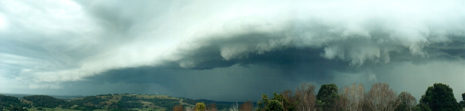
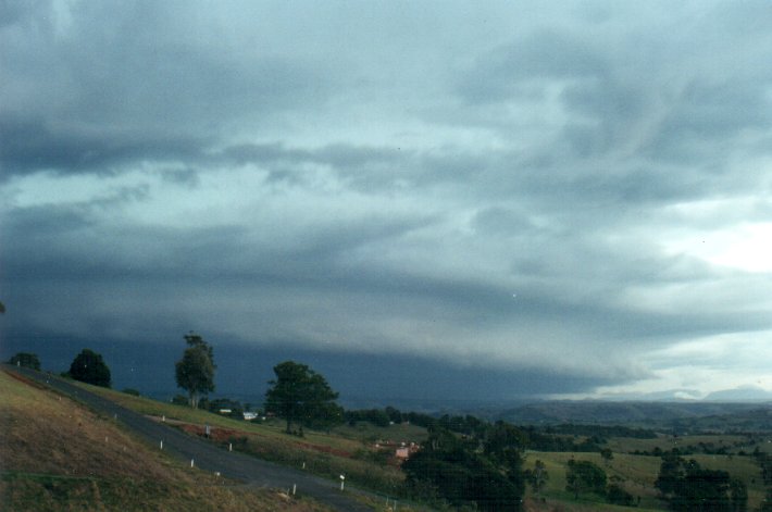
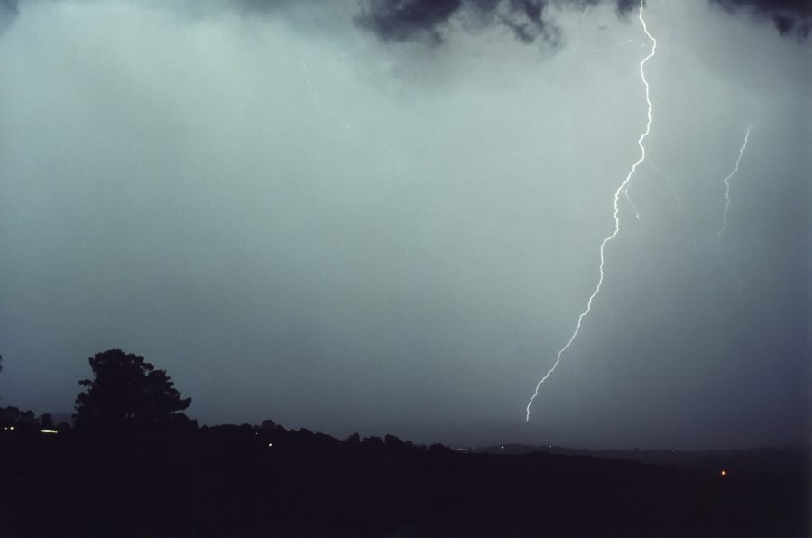
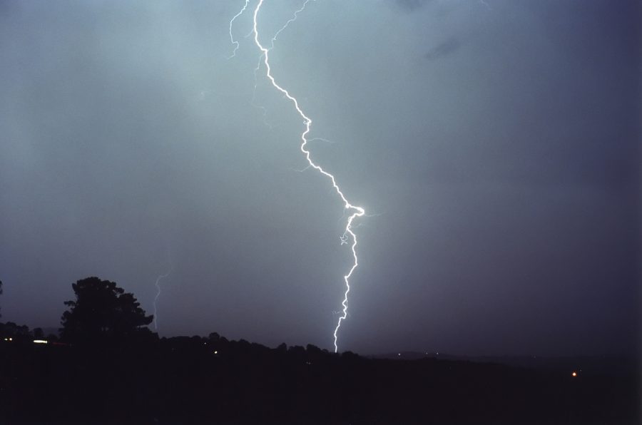
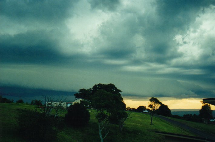
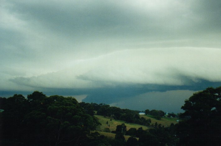
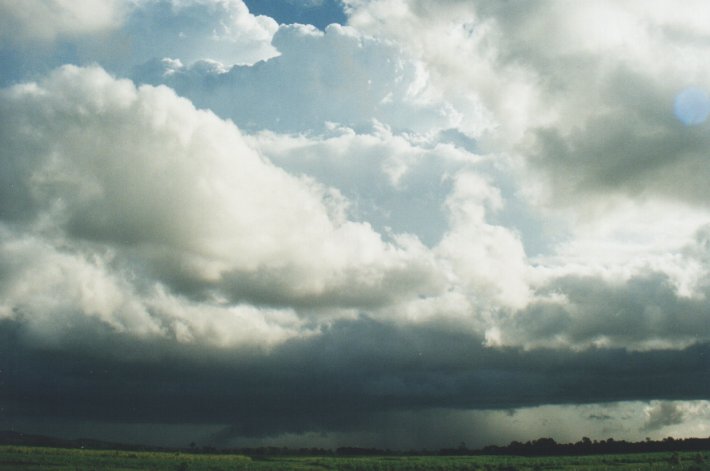
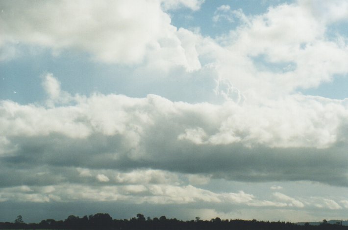
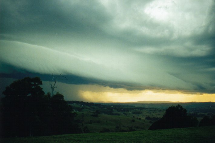
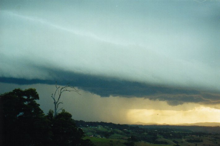
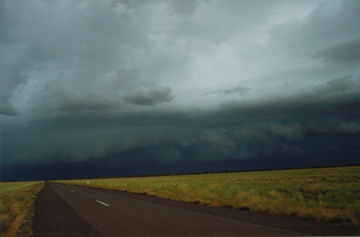
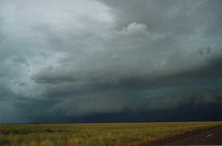
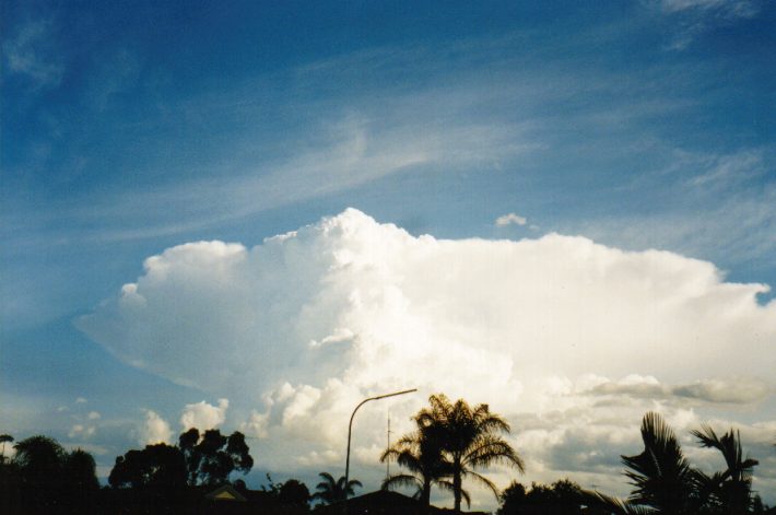
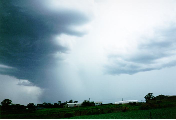
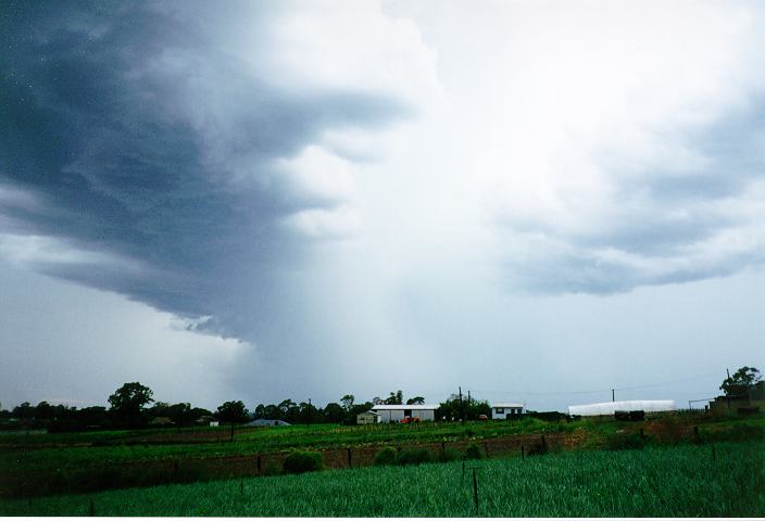
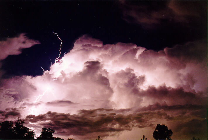
Severe Thunder- storm images of the month: November 2000 This months photos |

The 25th October 2000 really fired up in spectacular ways in NE NSW and SE QLD. Thunderstorms were widespread and in places severe. A large line of severe storm activity spread through the Richmond Valley of NSW, from Casino to the coast producing this magnificent shelf cloud formation photographed just south of Alstonville. On the northern flank (right in the second photo) many intersting base lowerings occurred which are not always associated with shelf clouds, and may in fact have been a wall cloud. Refer to the full report for details. Later on a second shelf cloud moved through the region and gave on nice lightning show as it approached. |
|
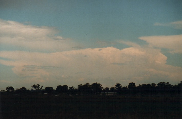
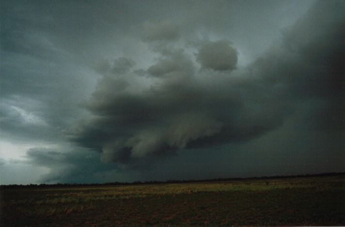
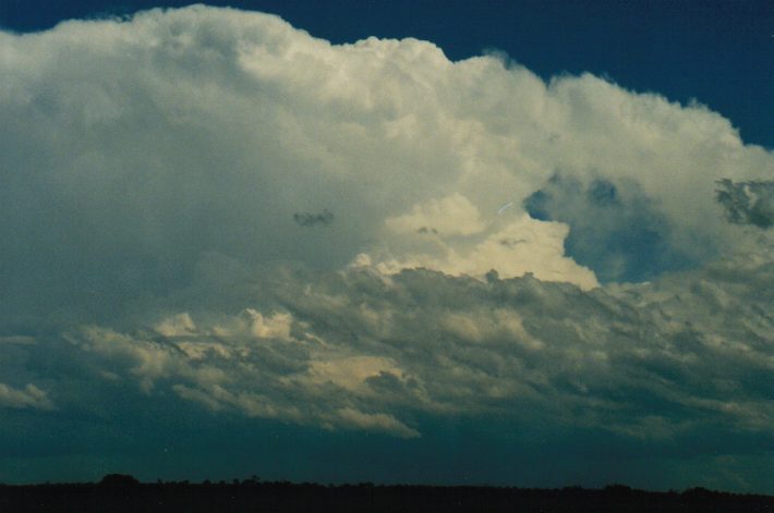
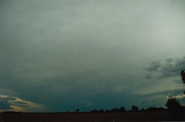
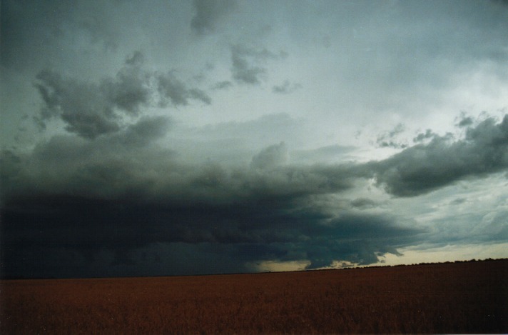
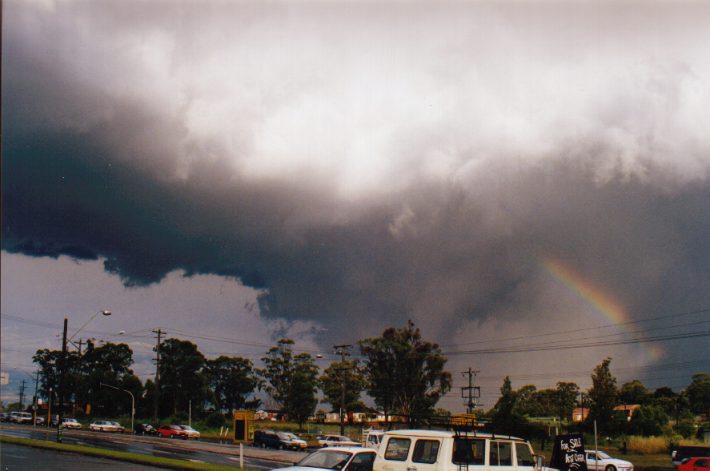
Severe Thunder- storm images of the month: October 2000 This months photos |
  The storms during the afternoon exhibited suspicious lowerings under the main updraught region.
|
|
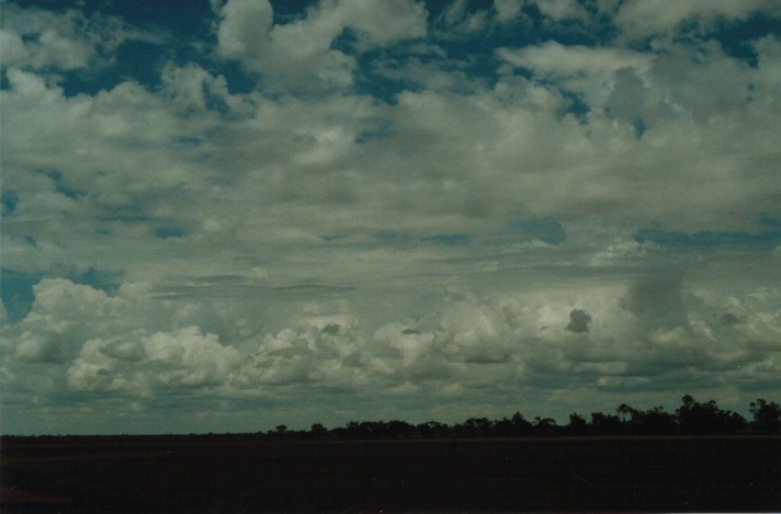
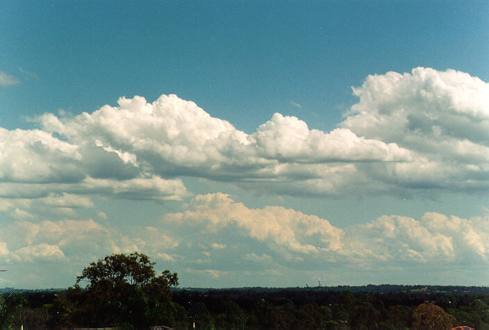
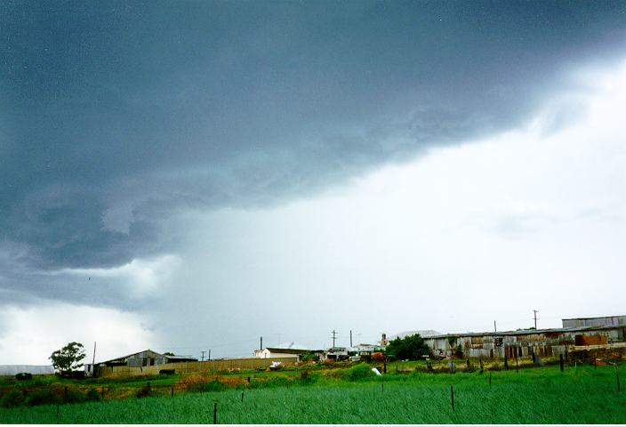
Severe Thunder- storm images of the month: September 2000 This months photos |
By mid-morning large, bulging cumulus developed rapidly near Bathurst. Storms developed from these large cumulus and broke straight through the cap. They were forming along a line followed by the drier air. Gradually they formed into a squall line structure which dissipated as it moved towards Sydney.
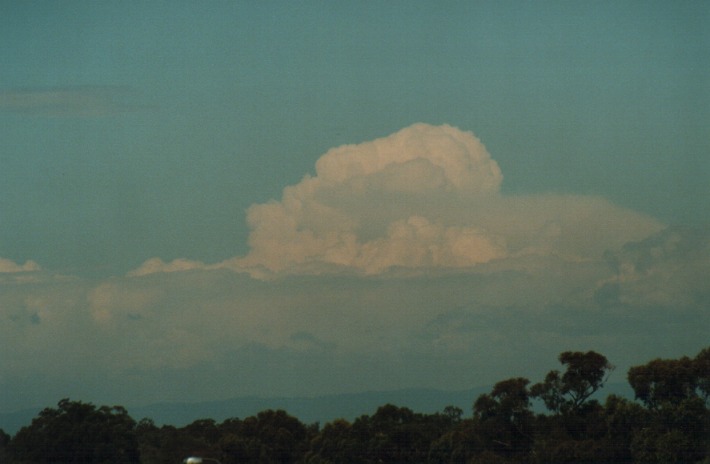 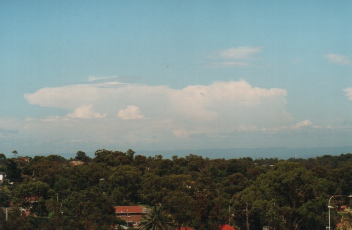 During the afternoon, more storms developed behind the squall line band. One persisted and moved towards the south coast near Nowra to eventually move off the coast.
|
|
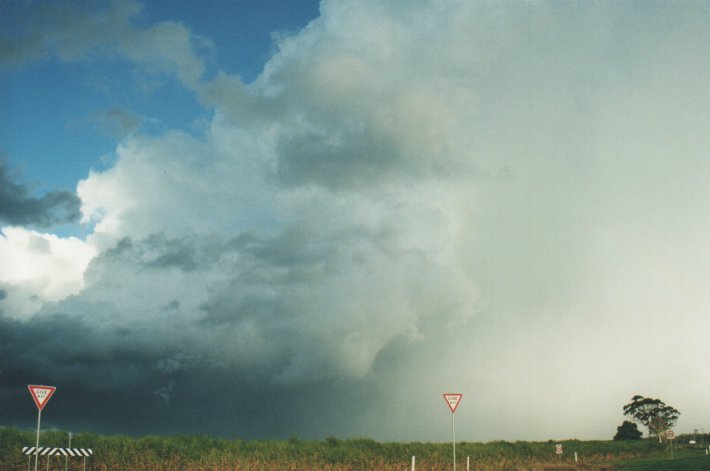
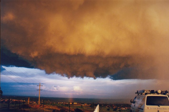
Severe Thunder- storm images of the month: August 2000 This months photos |
The squall line developed with some very spectacular gust front features. This event was certainly unusual as it exhibited a more summer like feature but occurred in the middle of winter. Hail and very heavy rain was observed with this event at McLeans Ridges near Lismore in north-eastern NSW.
  |
|
Severe Thunder- storm images of the month: July 2000 This months photos |
A squall line developed with some very spectacular gust front features. It was interesting that the alignment of this squall line was almost east to west. This meant that the formation of cells was on the eastern side and moved gradually left along the line. Together with such flat land features, this certainly formed one of the most picturesque storm formation on the "Thunder Down Under Storm Chase 1999".
  |
|
Severe Thunder- storm images of the month: June 2000 This months photos |
Later, secondary cells developed near the earlier Wisemans Ferry cell (that had moved off the coast). This cell exploded as it hit the jet over the lower Hunter region. An unconfirmed supercell was sighted moving through Maitland with large hail. The hail from surrounding storms was widespread. The storms eventually moved through Paterson and towards the coast north of Newcastle.
 |
|
Severe Thunder- storm images of the month: May 2000 This months photos |
|
|
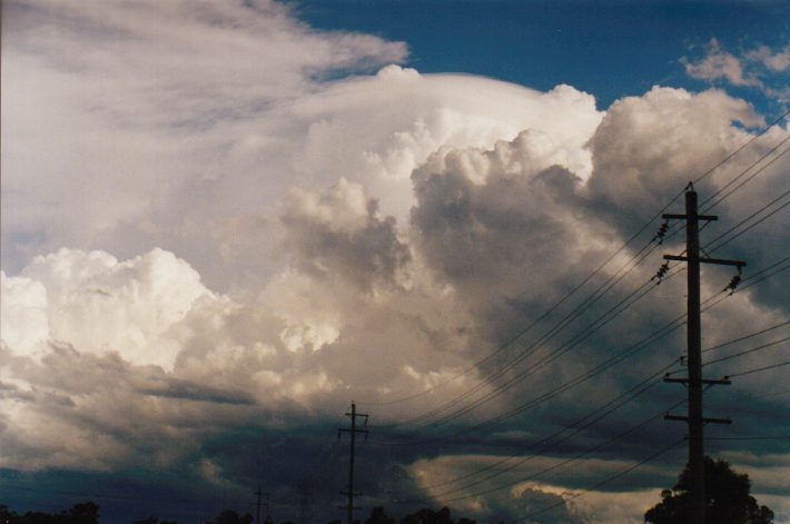
Severe Thunder- storm images of the month: April 2000 This months photos |
20th January 1996. This storm system occurred over a couple of days. The previous day had produced a spectacular thunderstorm. Well this storm event was not as spectacular but far more severe. Cells developed during the afternoon. One cell in particular was located to the north of Schofields. I watched as this cell develop along its southwestern flank which meant it approached Schofields. I saw the white in the trees half a kilometre away approach and suddenly we were hit by a microburst. Hail to about 1cm and very heavy rain pounded the window driven horizontally by winds up to 120km/hr in strength. It lasted about 6 minutes and then moved further southeast. It was these storms that tracked towards the lower north shore and dropped a funnel which wiped out several trees in the area. There were many suburbs affected by damage mainly along the path of this storm.
|
|
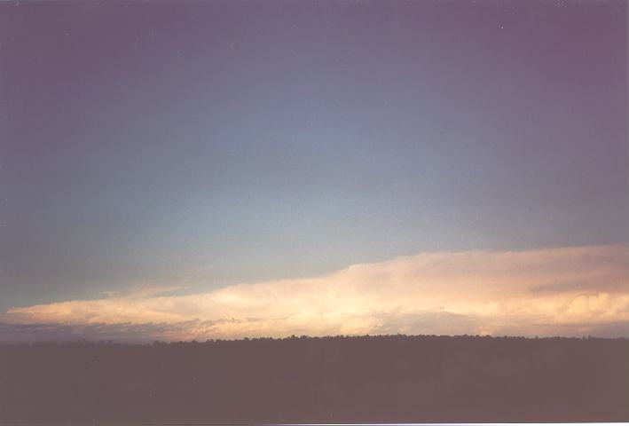
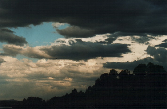
Severe Thunder- storm images of the month: March 2000 This months photos |
During the evening, cloud began to increase and indicated chaotic behaviour. A band of eletrical storms passed over during the night. Some spectacular lightning were observed with some lightning coming out of the side of the cloud! This was the first time I had ever observed this but maybe because this particular storm was isolated and nearby.

 |
|
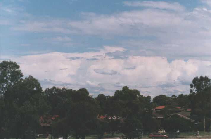
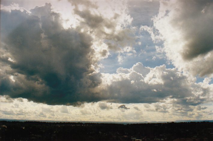
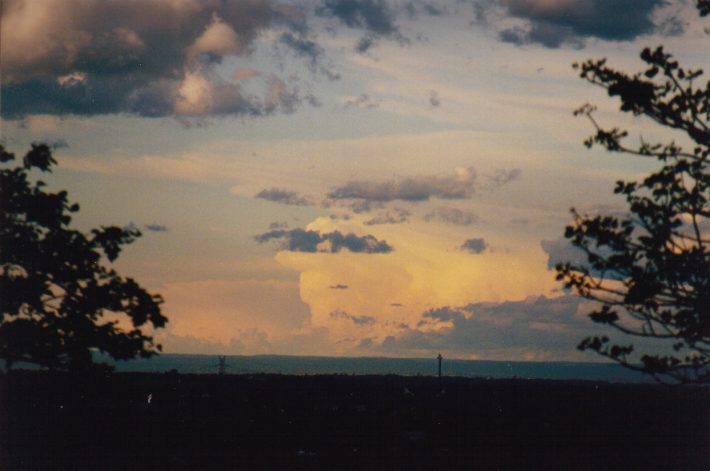
Severe Thunder- storm images of the month: February 2000 This months photos |
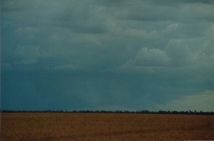
It may have been
somewhat of a surprise, but 24th October 1999 was a supercell outbreak on the
north coast of New South Wales and SE Queensland. 
 The storms then moved rapidly offshore. |
|
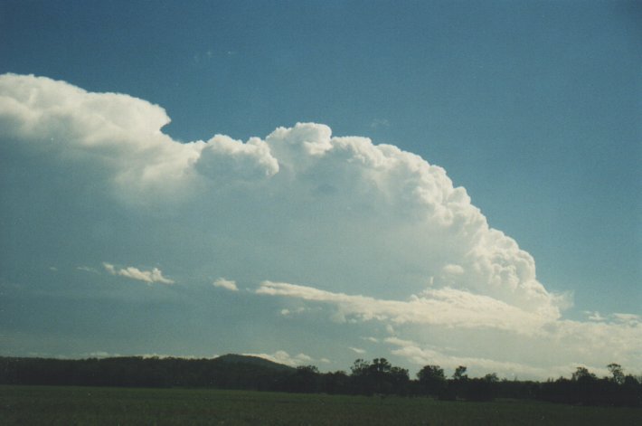
Severe Thunder- storm images of the month: January 2000 This months photos |
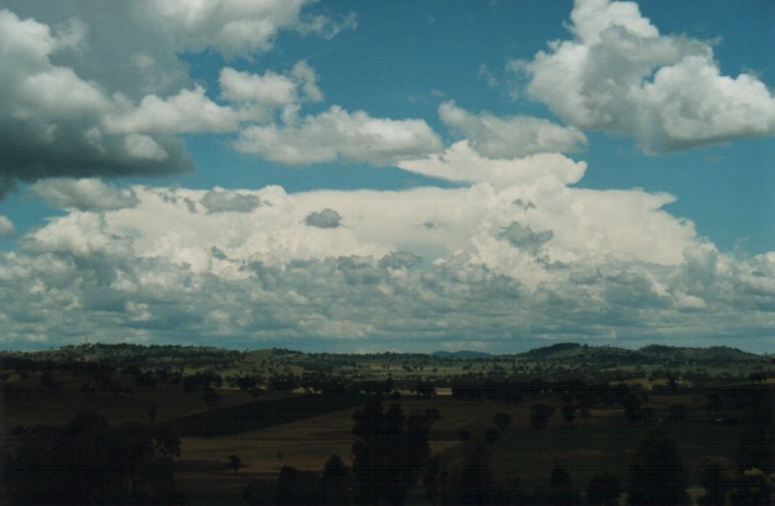
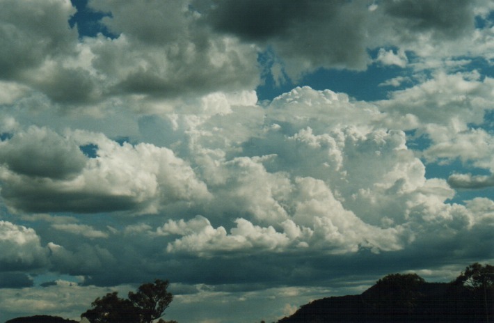
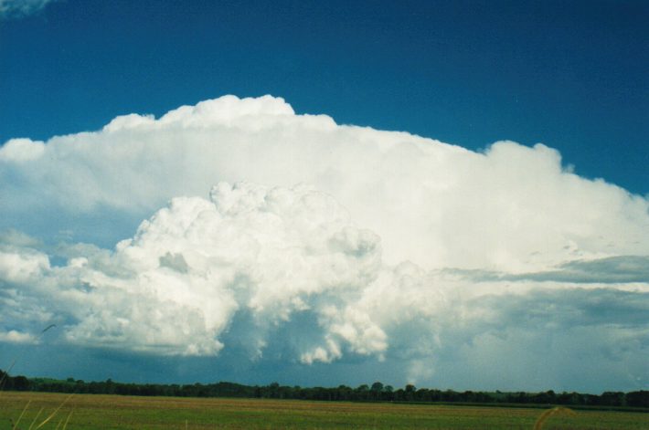
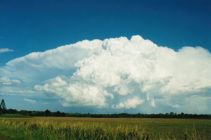
22nd November
1999 was a classic situation where supercells were likely to develop in southeast
Queensland. The storms developed with strong updraughts and this particular supercell
near Surat seemed to have a v-notch anvil. Although this last photo indicates something like a wall cloud area and inflow band, it was in between this and the precipitation core where the funnel and dust whirls occurred a few minutes after this photo. here are the slides of the dust whirls... 
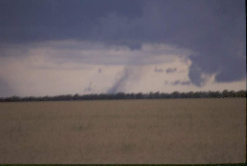
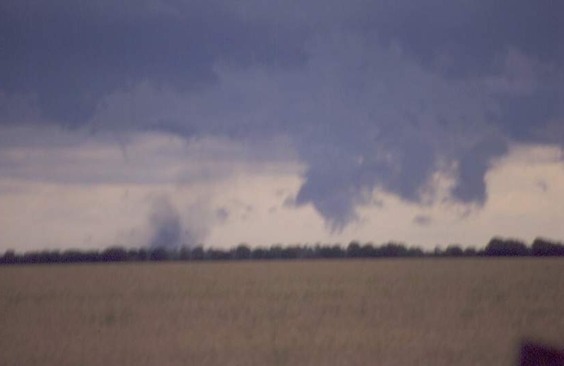
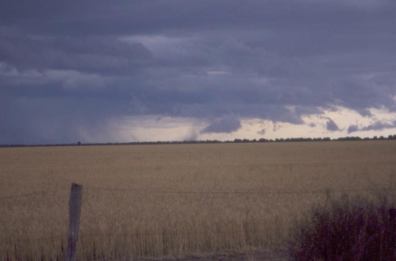 Note the funnel in the third slide. |
|
Document: arc2000.htm
Updated: 31st January, 2005 |
[Australian Severe Weather index] [Copyright Notice] [Email Contacts] [Search This Site] |