and Chasing
[Index][Archives]
Merging Supercells on the NSW North Coast Deliver Giant Hail: Tuesday 9th November 2004
by Dave Ellem and Michael Bath
| Storm News and Chasing [Index][Archives] |
Merging Supercells on the NSW North Coast Deliver Giant Hail: Tuesday 9th November 2004 by Dave Ellem and Michael Bath |
Today was one of those days where reading the models didn't tell the story. I
was rather shocked when I logged onto the net in the morning to read the Northern
Rivers forecast and see "afternoon thunderstorms with possible hail and squally
winds" mentioned, as we usually only see that sort of forecast on days where
severe storms look very likely. A bit confused, I loaded the AVN model to see
that it had forecast -1 to -2 LIs and surface cape of around 400 in the Northern
Rivers region. Typically on a day where hail and winds are in the forecast, you'd
like to see much lower LIs and higher cape, so I was a bit surprised! Talking
to Michael Bath later that morning, we both noted how the sky looked quite good
for severe storms. A thick early morning fog had lifted and the sky was filled
with plenty of cumulus, although there was some concern there was a little too
much. Still not quite sure what to make of the setup, I loaded the AVN surface
temperature forecast to see that it had plotted 18C to 20C over the Northern Rivers.
It now started to become clear why the LIs/cape were plotted so low and why the
BoM was forecasting hail and squally winds! I re-plotted the 00z Brisbane sounding
at 28/20, which I figured would be a more realistic max temp than what the AVN
model had suggested. All of a sudden we had LIs around -7 with cape getting up
to around 2500!! With plenty of low level moisture and generally good wind shear,
it was now much more clearer why severe storms were definitely on the cards! However
I don't think either of us realised just how severe storms were likely to be this
day.
As mentioned before, there was a
lot of low level cloud, and surface temps were a little lower than I would like
to see during mid morning. There was also virtually no capping, so convection
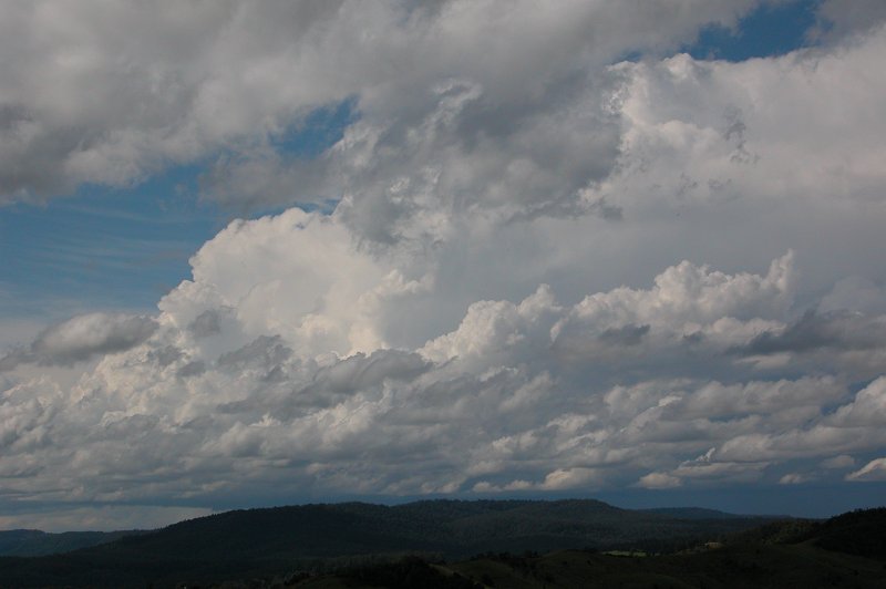
kicked off near Dorrigo by around 10.30am. Everything remained pretty weak looking
and very slow moving - not what you'd like to see on a typical severe storm day.
When Michael finished work at 1pm we had a chat and decided it would be best to
be out west of Casino as it looked as though severe weather would have to develop
at some point and we would need to be out there already to get it. So at 1.30pm
we headed off to Mallanganee, west of Casino. There was nothing impressive the
whole trip out - mostly junky Cjs and weak Cbs. We made mention during the trip
out how it had been such a boring run of weather and that we would love to experience
a day like last year's supercell outbreak on October 25th which gave us giant
hail. But it was looking very grim once we were at our target area at Mallanganee,
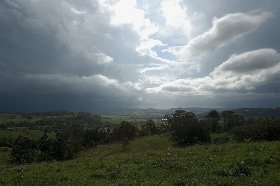
with only very weak development. Around 2.40pm, things began to get more interesting
as some ok looking updrafts developed behind a weak looking storm to our SW.
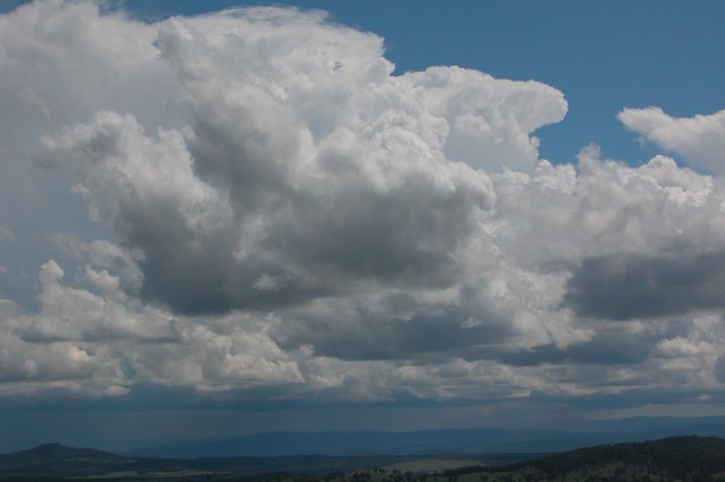
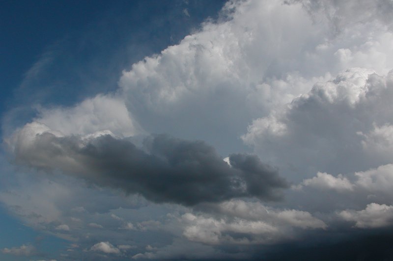
These ok looking updrafts continued
for a while, lifting our spirits that something might just take off. By 3.14pm,
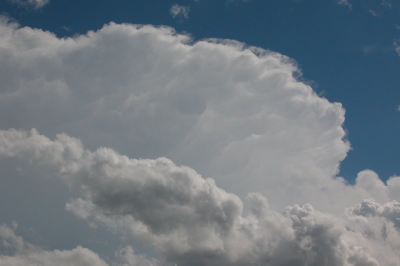
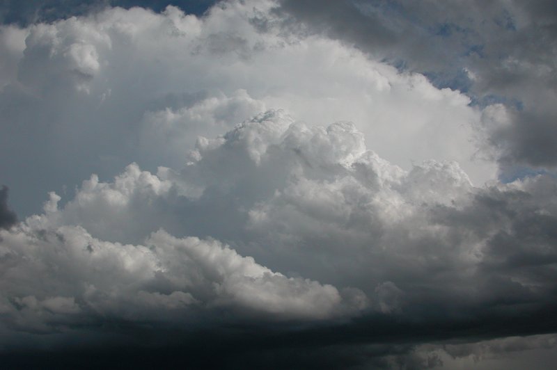
to our great excitement, one powerful looking updraft burst through the low level
cloud and gave a spectacular looking cumuliform anvil, complete with knuckles,
a nice rain foot underneath, and plenty of CGs! Boy was it a sight for sore eyes!
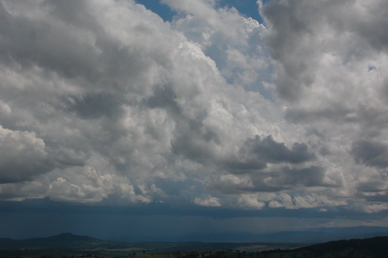
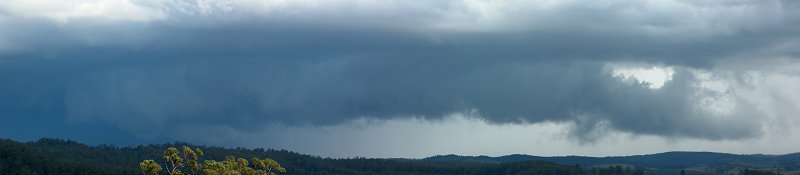
Unfortunately for us, this period of stronger development was short lived. By
3.30pm the storm looked to be weakening again as the anvil seemed to lose its
crispness. What was interesting at this point was a lowering that developed underneath
this storm. Michael has commented many times before that these lowerings seem
to appear on hailstorms, and it looked as though this lowering was indicating
a new updraft region in the storm. We kept a close eye on this lowering, which
persisted for some time. We also began to watch quite a nice looking cell NW of
Kyogle, which we were a little annoyed about in one sense as we assumed it would
be heading E, possibly NE, taking it further away from us.
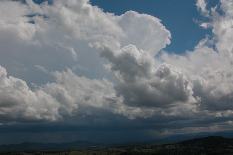
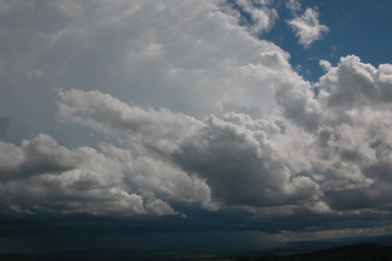
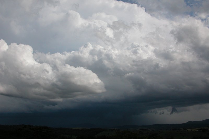
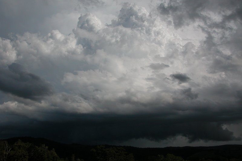
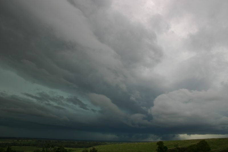
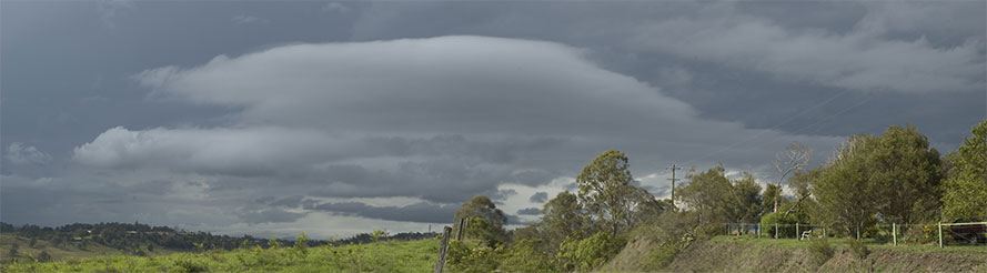
Things began to get almost frantic from this point
onwards! At 3.45pm it was becoming clearer that the cell to our S was getting
organised and becoming severe, as the persistent lowering appeared to be developing
into a fully fledged gustfront. A beautiful crisp updraft was now pushing up to
our SSW, and the storm's anvil now seemed higher and more cumuliform once again.
We were further frustrated after a radar update on the laptop that the cell to
our south now appeared as though it would continue to track ESE to E, making an
intercept almost impossible due to the poor road network. As we were discussing
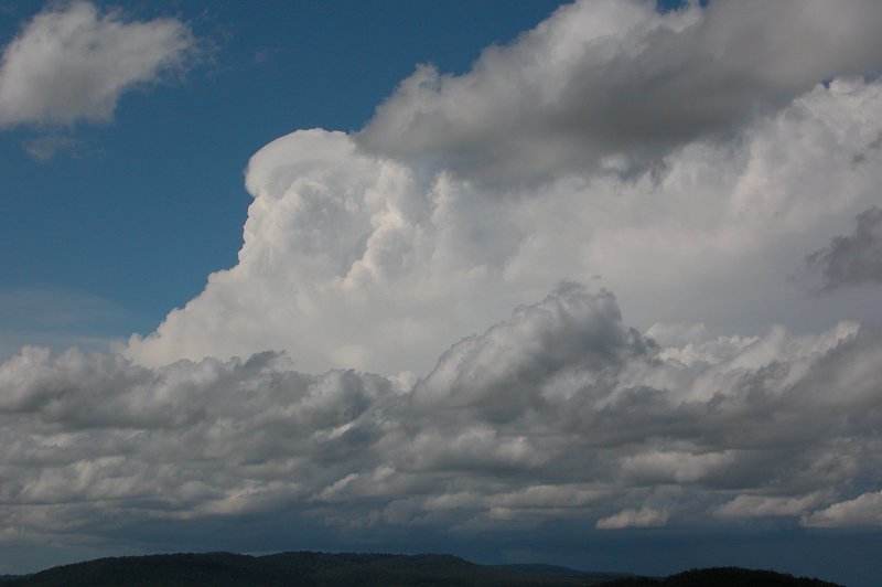
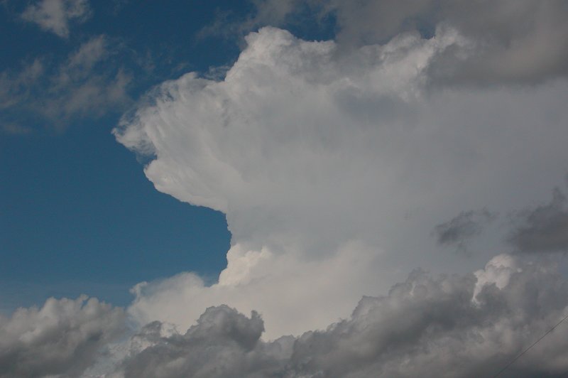
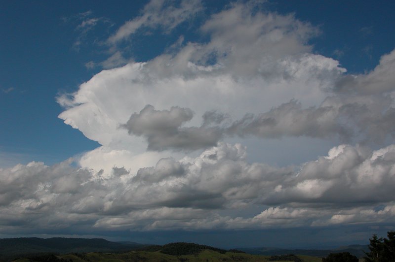
what to do, we noticed the cell NW of Kyogle was all of a sudden completely covered
in pileus - it was a pretty incredible sight for a pileus lover such as myself!
It was now around 3.50pm.
Things were sure changing quickly from here. In a matter of minutes, quite a nice
gustfront was forming on the cell to our south and the cell NW of Kyogle was continuing
to explode, with more pileus developing on a fresh updraft. Looking at the updraft
of the cell to our south, it was beginning to look more and more like a supercell,
however we didn't make the call at the time as it seemed borderline and we couldn't
pick any updraft rotation.
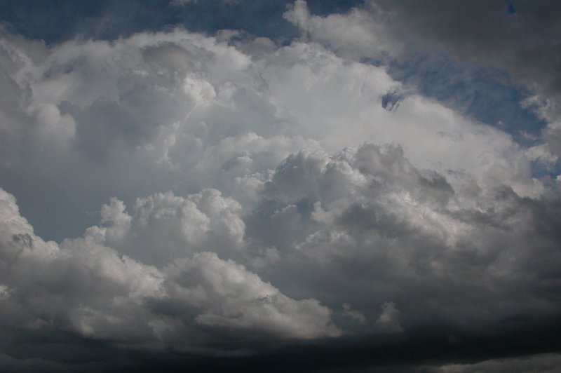
We were now almost certain the cell to our south was producing hail, and given
the nice cool upper levels and generally slow movement of the cell, we thought
hail drifts were on the cards, so we looked again at the map trying to see if
there was any possible way of getting closer to it, or even behind it to see if
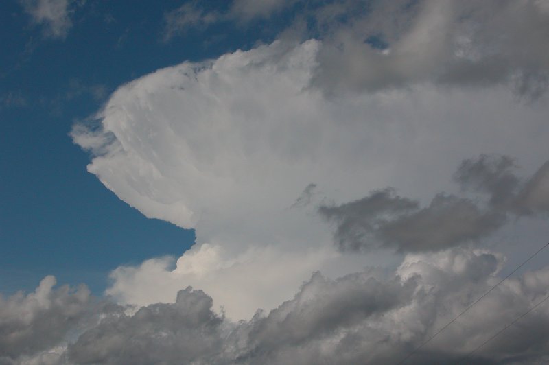
it had left behind any drifts of hail. But while we were looking at the map, the
cell NW of Kyogle just EXPLODED!!!! A MASSIVE updraft that looked like an atomic
bomb going off blasted up out of the pileus! It was one of the most explosive
updrafts I have witnessed. Words can't really describe the spectacle of the rapid
explosion.
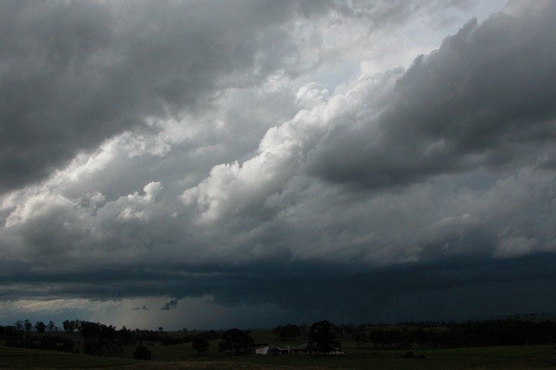
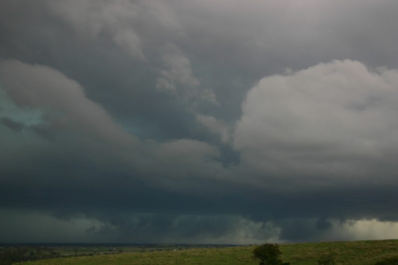
Most of my attention was on the cell near Kyogle for obvious reasons, but
the cell to our south was also becoming quite a sight! A pretty good looking gustfront
was now well established below a strong updraft, and it was pretty clear that
this storm was going to be severe. We figured we would try and head to Casino
and shoot south of town towards Leeville in an attempt to get closer to the cell.
After a final photo of the amazing storm near Kyogle we jumped in the car and
set off for Casino at around 4.00pm. Things were now about to get VERY exciting!
On the drive to Casino, Ray Mullens phoned to inform us that both cells were
on a collision course for one another, and it appeared they were going to collide
near Casino. We couldn't believe the news! One cell heading SE, the other NE!!
It was almost like being in between the two Casino supercells in January
2001! The question was, which one should we target. The other thought playing
in the back of our minds was that as they neared each other, they could potentially
kill each other by cutting off the nice supply of moist, warm air. Ray informed
us that the one NW of us was stronger on radar, exhibiting a large red core. The
one to our south was also red on radar, though its core was a little smaller.
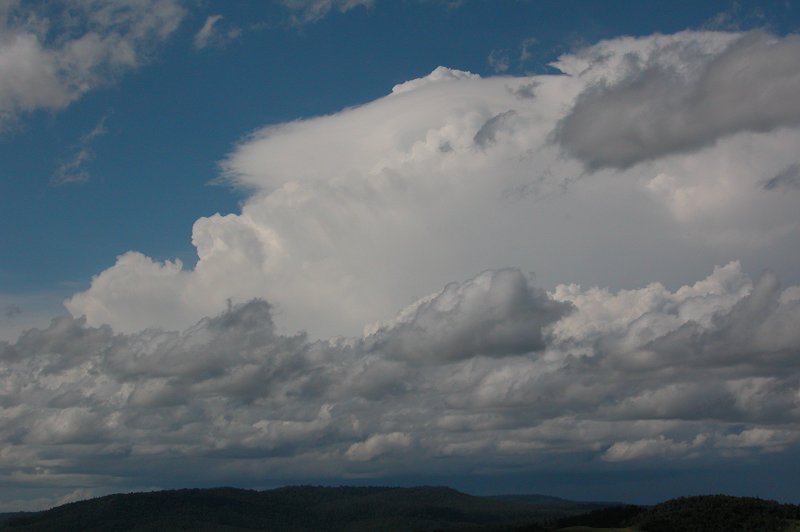
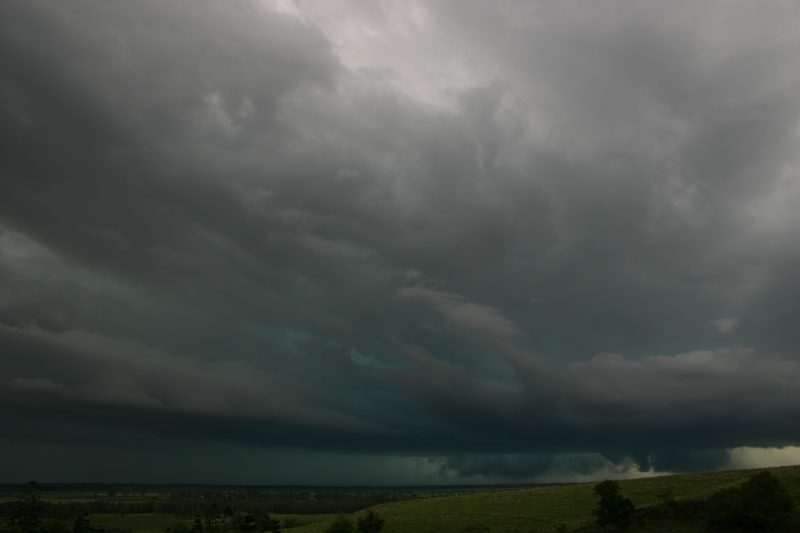
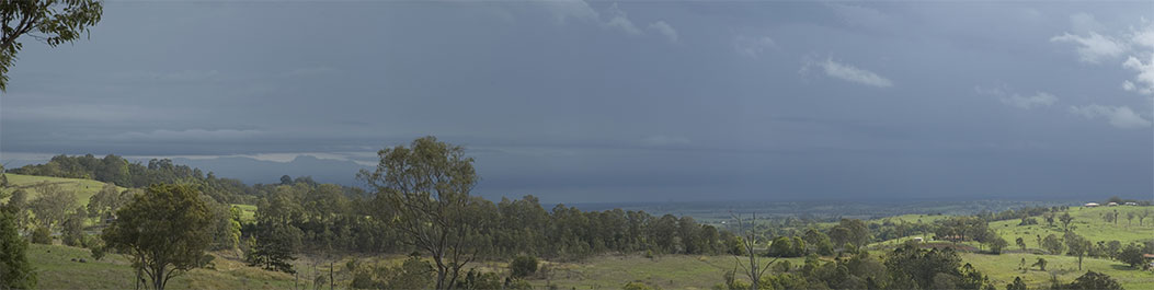
The trip back to Casino goes through some treed in areas surrounded by hills,
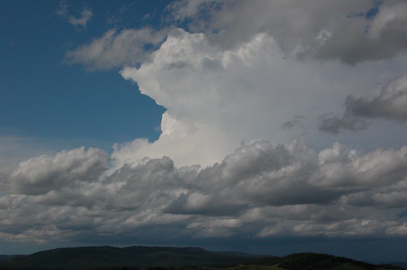
so it was hard to make a visual judgment until we were almost near Casino. We
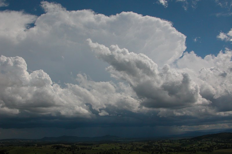
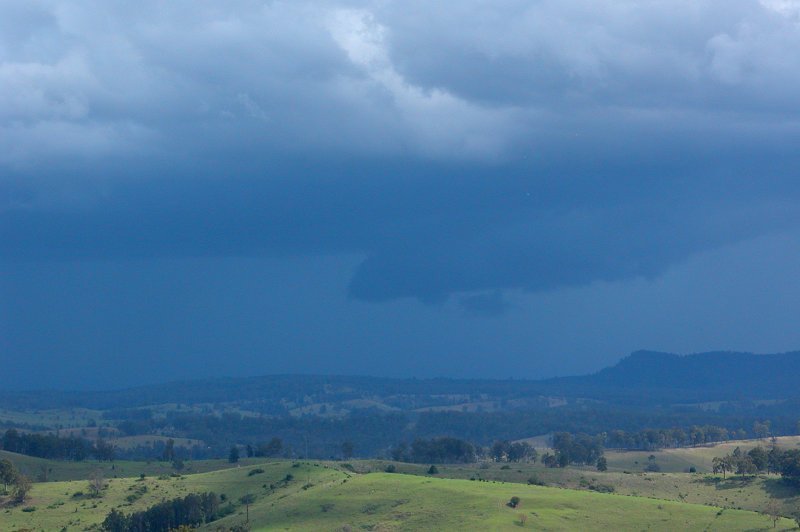
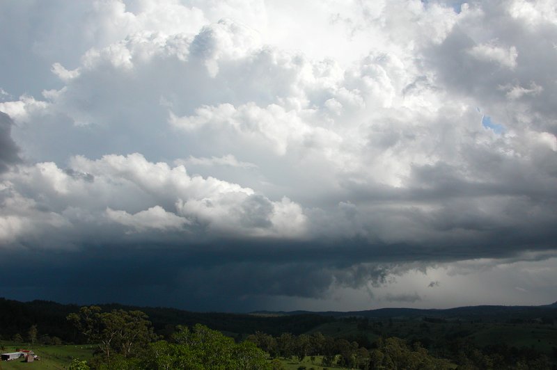
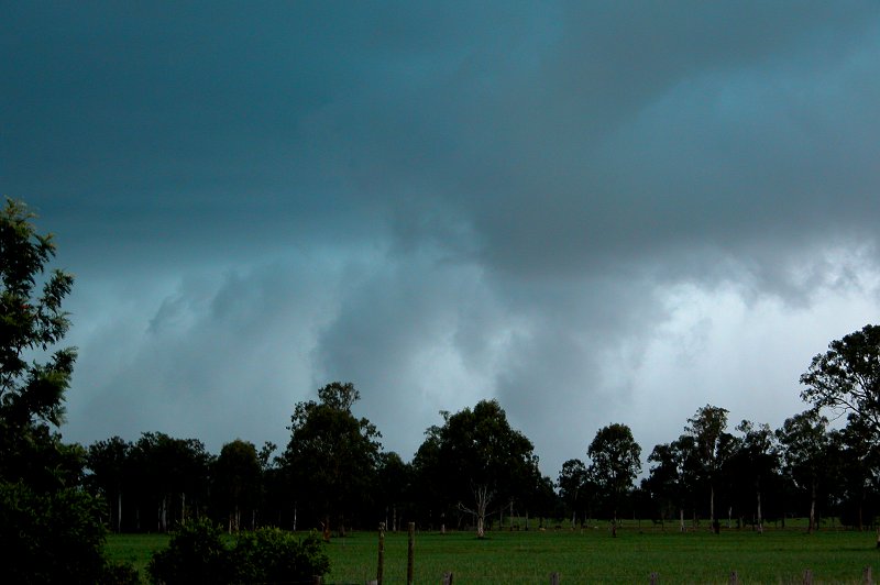
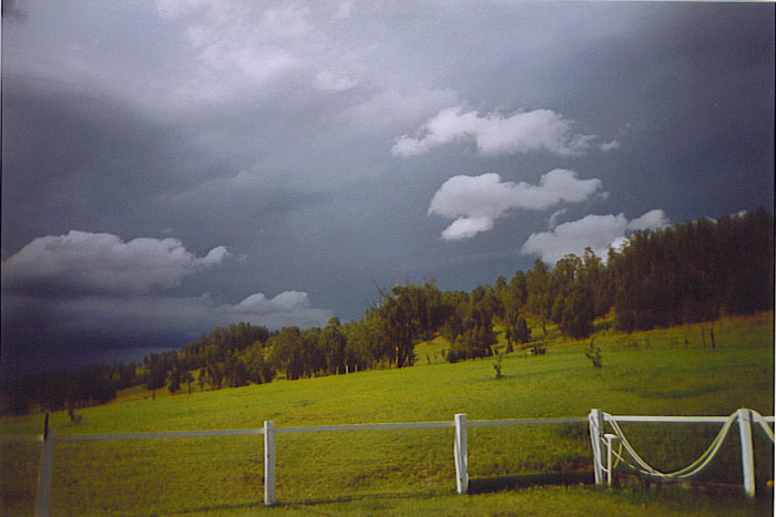
stopped briefly to observe. The cell to our NW, as pictured below, looked to be
producing some intense weather, but the cell to our south looked like a real beast,
with a gustfront dragging along the ground and an amazing green colour in the
clouds.
Just then, Ray rang again to confirm the cell to our south now looked more severe
on radar. So we headed south to look at it. On the trip out we could see multiple
large inflow bands - quite a large one in the distance that fed in behind the
storm where the gustfront/probable meso was. Surface inflow winds right up until
we were just about in the storms were very strong - some of the strongest inflow
we have observed. It is unclear whether this strong inflow was in fact outflow
from the northern supercell, but it did still feel rather warm and humid. Another
smaller inflow band was feeding into the storm almost overhead. Because we were
racing south, we unfortunately didn't have time to get good structure photos.
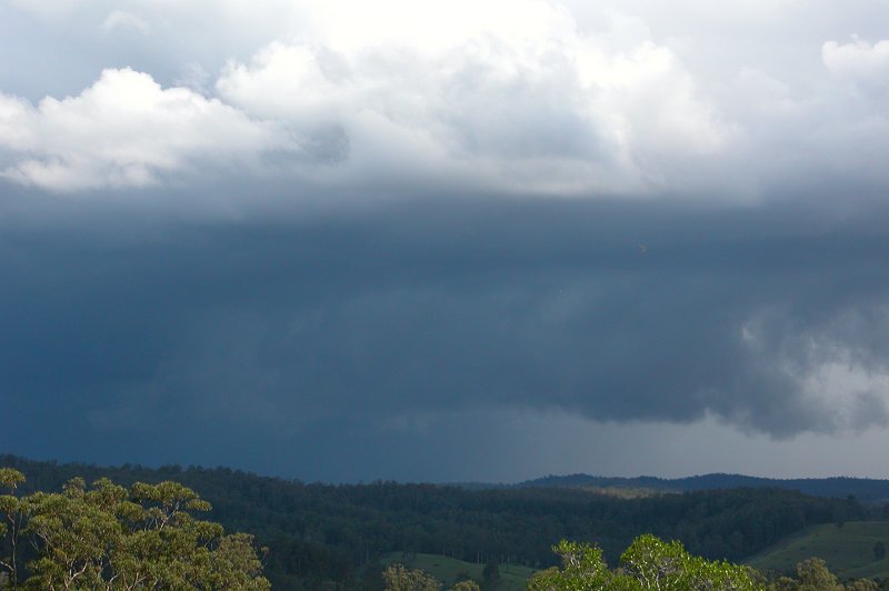
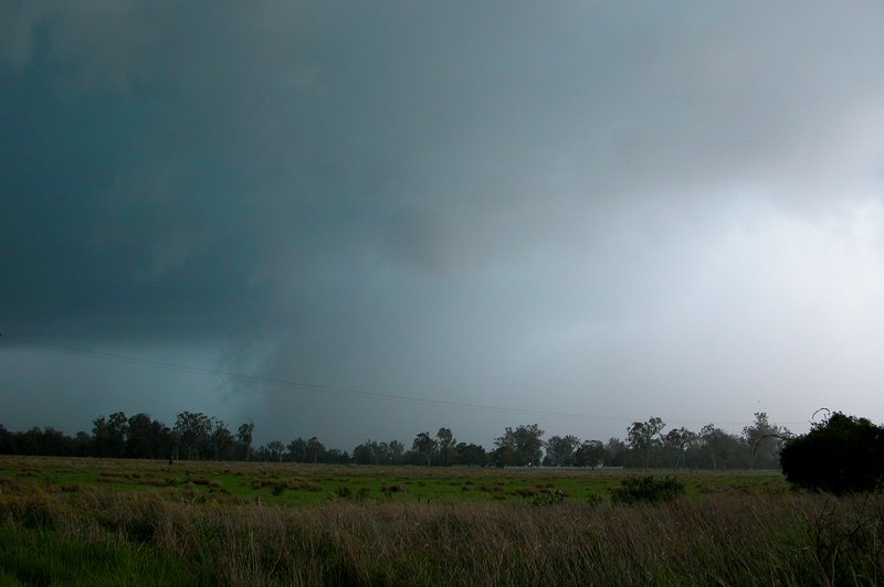
We stopped just ahead of the storm for a few very quick shots of the guster which
was touching the ground at 4.29pm. The green colour in the clouds was nothing
short of amazing! As I took one of these photos a flang hit behind me - Michael
and I aren't sure how far away it was, but it was close! I was promptly ordered
back into the car by Michael!
As we approached the storm at Leeville, Michael spotted some pretty dramatic
rotation- probably some of the fastest rotation we have observed. As we drove
under the mesocyclone, we drove through a rotating cloud of small debris, so there
was obviously some small circulation going on at the surface under the mesocyclone,
but not strong enough to do any damage. In hindsight, it was at this point that
we should have stopped. While there was no really dramatic indication of the storm's
intensity such as a well defined mesocyclone or gustfront as we have seen on HP
supercells in the past, there were a number of less recognisable indications of
how severe the storm was, which we didn't add together until it was all too late!
At about 4.32pm we drove into the storm's precipitation area, receiving some strong
to severe winds and heavy rain. But to our surprise, there was no hail!! We had
expectations of coming into the storm and finding hail drifts of 2-3cm hail, as
we had discussed earlier, however there wasn't a single hailstone! We never said
it but it turned out we were both thinking at the time that we were probably only
going to get heavy rain, as we have chased so many storms in the past which looked
to have hail for certain which didn't! After a few minutes of boring heavy rain
footage, I turned the video camera off as I thought it would end up being nothing
but rain footage. Then out of nowhere and with no warning - SMASH!!!!!! Gorilla
sized hail being propelled by winds of around 90km/hr came bouncing across the
paddocks and road and SLAMMED us!!!! Within seconds the windscreen had began to
smash. I was terrified - all hell broke loose!!!! I thought we were going to lose
the windscreen and didn't know whether to jump into the back of the car. Fortunately
Michael acted quickly and turned the car around as soon as the massive hail hit
and we got out of there as fast as we could. But the damage was done. Within maybe
30 seconds (felt like 10 minutes!!), the windscreen was completely smashed up.
It was absolutely terrifying!!! I was freaking out on one side of the car while
Michael quietly mentioned 'I think I'll need to get some repairs done'! We pulled
up a few kms from where it occurred and immediately phoned the BoM and local SES
to let them know of the storm's severity. We started to get a few 3cm to 4cm hailstones
where we had stopped and I started freaking out again, but nothing larger hit
after that. We composed ourselves (well, I composed myself, Michael seemed to
be ok!) for a bit and then drove back in to see what had happened. Firstly, here's
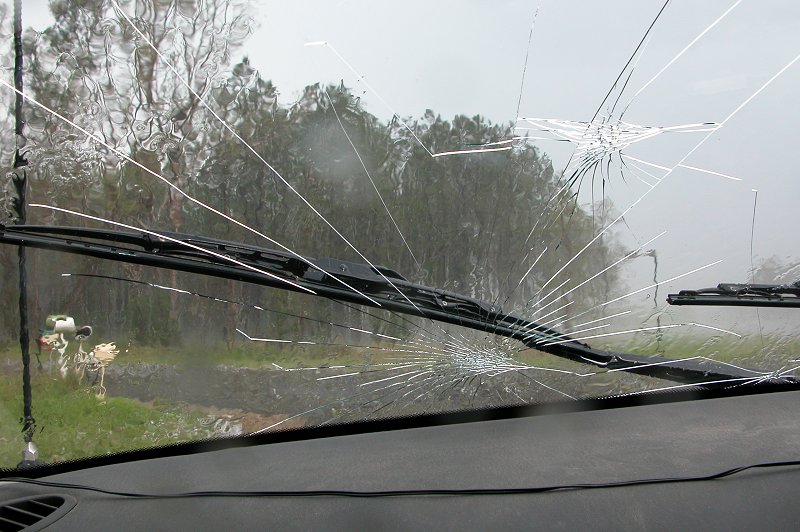
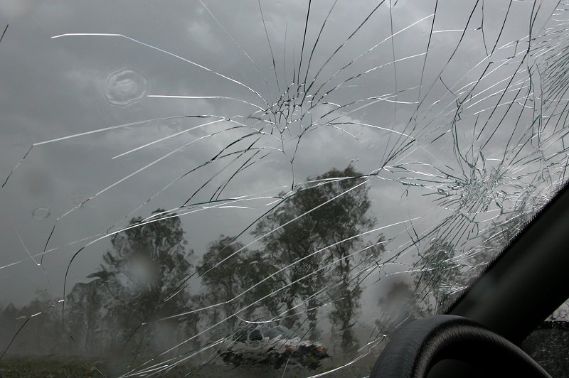
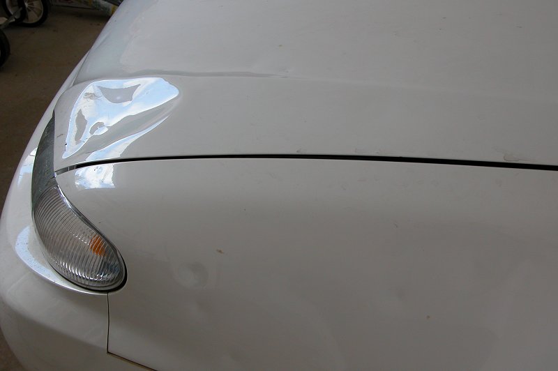
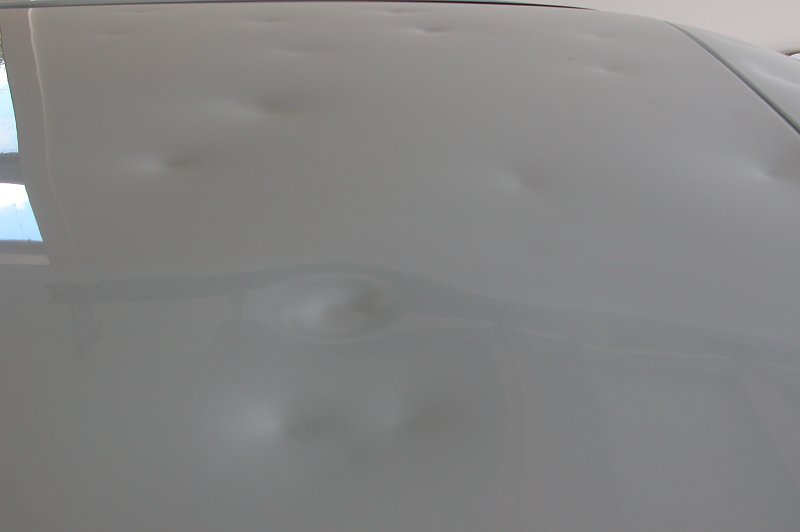
some photos of the windscreen and panel damage! 30 seconds in the vault region
of the supercell had left us with 14 separate hail impacts in the windscreen and
50 dents right over the entire car. Every panel was damaged. We also measured
a dent in the front of the car that was 15cm wide!!! Obviously a number of giant
hailstones were needed to do that sort of damage!
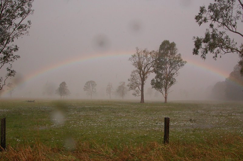
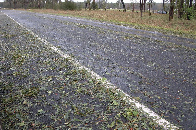
As we pulled up near where we had encountered all the hail, we noticed the
paddock to our left was covered in large to giant hail, with a lovely rainbow
to top off the scene! We had to wait a few minutes for the rain to stop before
we could get out. There was also the concern of lightning as some CGs were still
hitting rather close by. After a few phone calls to family members and friends
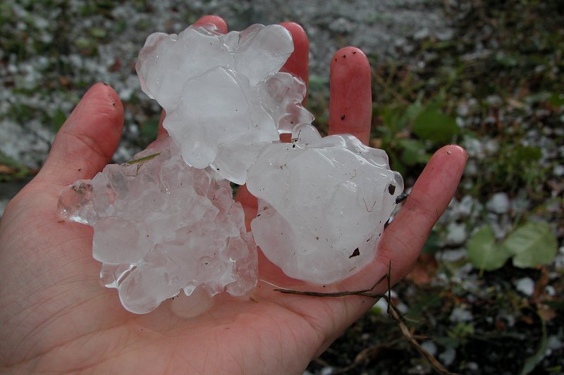
to let them know what had happened, we eventually got out of the car and found
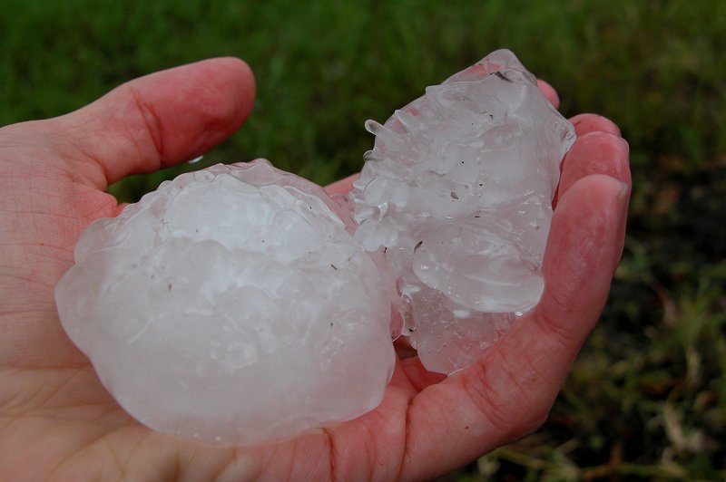
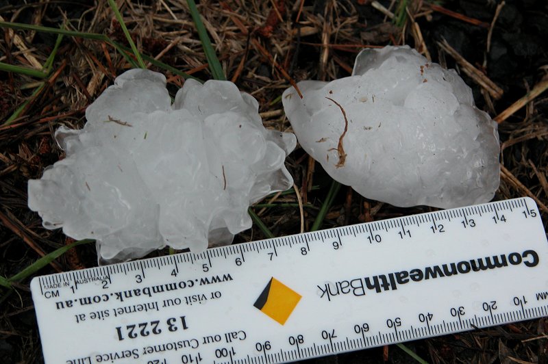
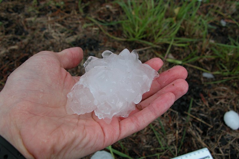
numerous round and very solid 6cm stones which I couldn't smash when I threw them
hard at the road. Further searching around found a number of 7cm stones and one
8cm stone. We are pretty confident there were larger stones - possibly up to 9cm
going by damage to the car and some of the hailstones seen flying past the window
on the video. But officially 8cm is the largest we measured.
At about 5.20pm we headed back to Casino, logging onto the net via the laptop
to let the AustPacWx email list know what had happened and to meet up with Rodney.
If only we had the video camera rolling when he saw the front of the car - his
face was priceless!!! We watched another line that moved through for a bit but
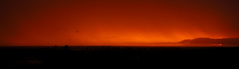
then grabbed some dinner and headed home. On the trip back, we stopped at Parrots
Nest for a photo of the sunset. The whole sky was filled with this eerie glowing
orange colour. It was the strangest feeling for Michael and I..we were feeling
like 'did that just happen'. It was a feeling similar to when we experienced a
monster HP Supercell at Casino in January 2001.
It was amazing to see how much rain had fallen across the area on the trip back.
As the two supercells collided near Casino, both collapsed in a dramatic fashion,
dumping up to 3 inches of rainfall in some areas and giving severe wind gusts
of up to 100km/hr. It was certainly welcome rain for a large part of the Casino-Lismore-Ballina
area, and very fortunate that neither storm survived to go on and devastate one
of the major towns. The chase had certainly been an incredible one. It was particularly
rewarding being able to watch a storm develop right from a small cumulus cloud
and then witness it as a HP supercell in full fury. Fortunately for us it wasn't
to be our last chase, but the chase vehicle will be out of action for a while!
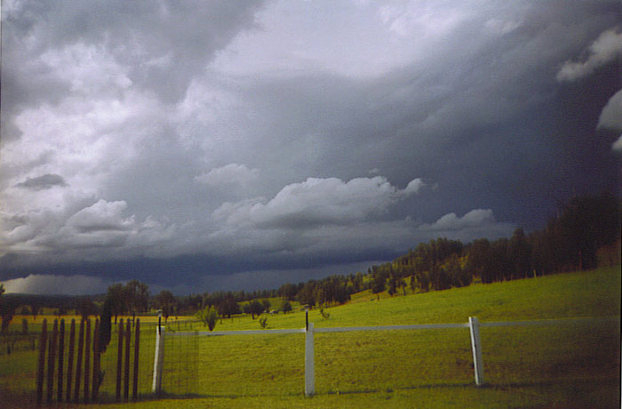
Additional photos
These photos by Rodney Wallbridge east of the storms:
These photos by Ray Mullens east of the storms:
These photos by Vicki Joy of the storm NW of Kyogle. She describes watching "little twister like forms for about 20 mins before the storm hit":
From Weatherzone
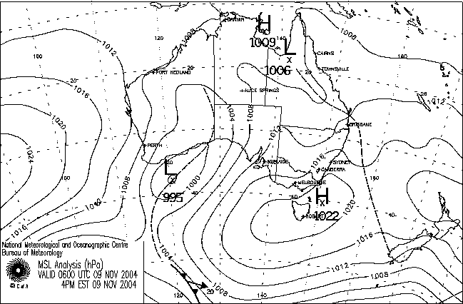
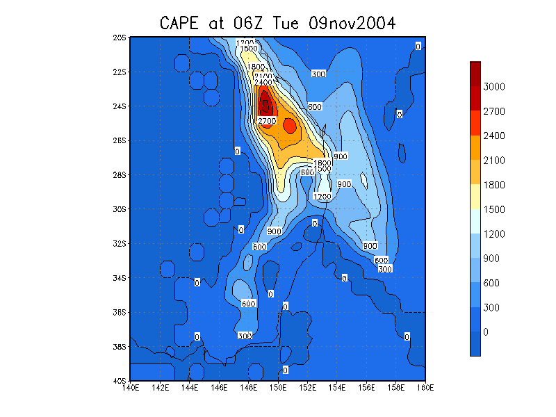
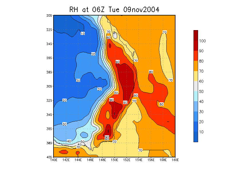
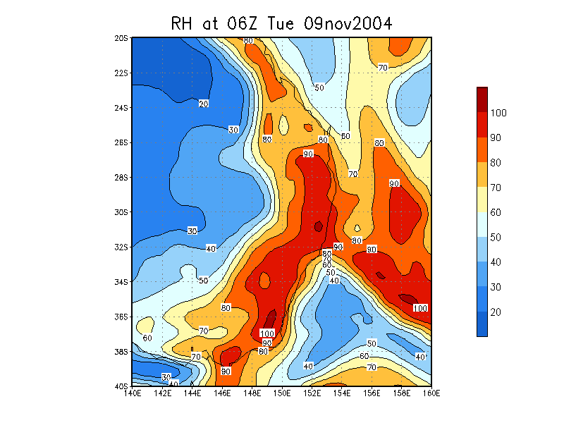
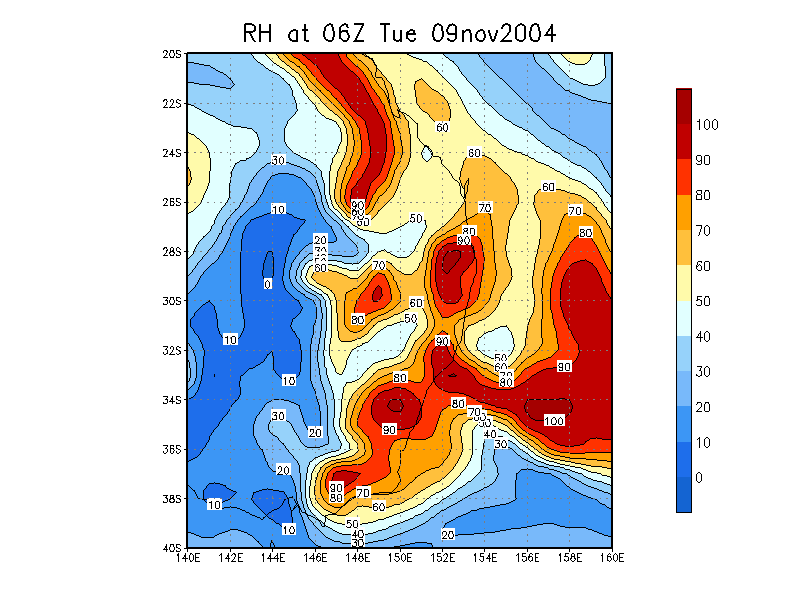
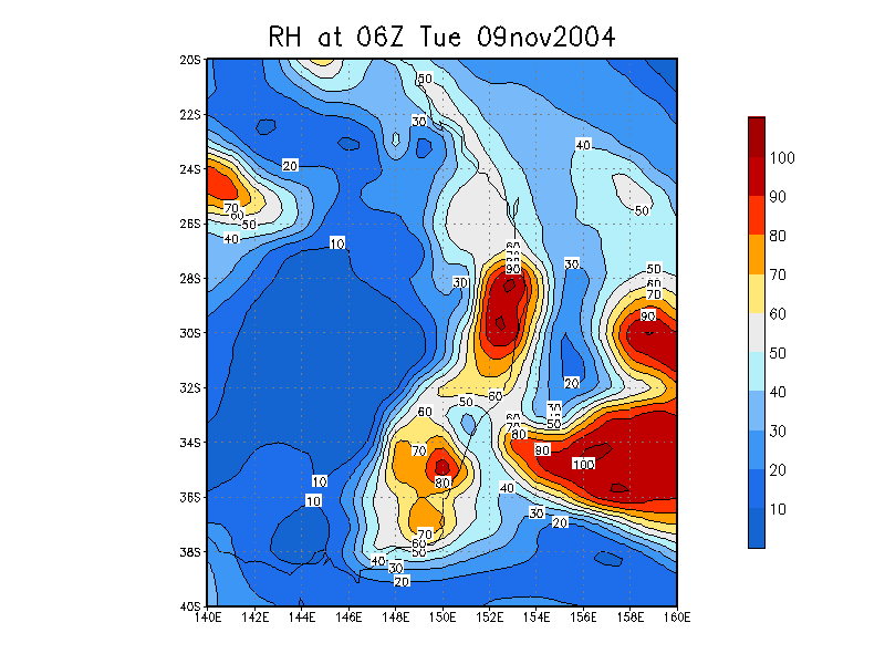
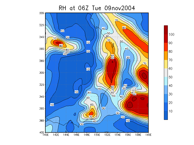
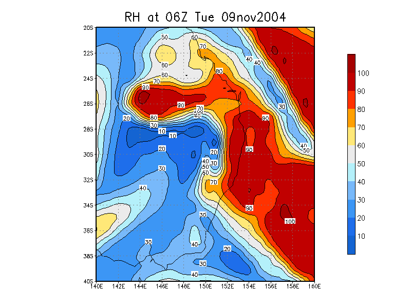
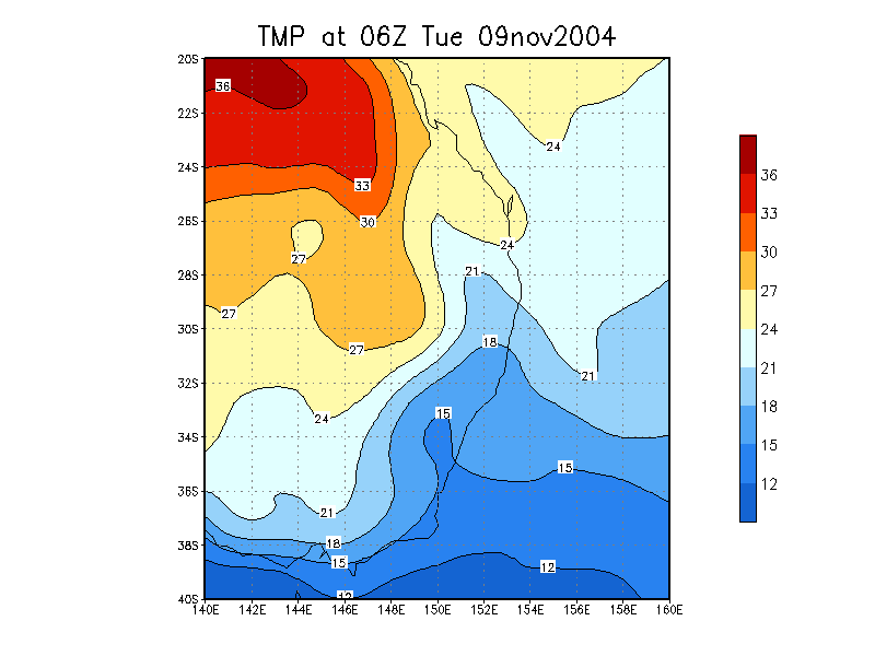
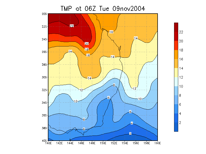
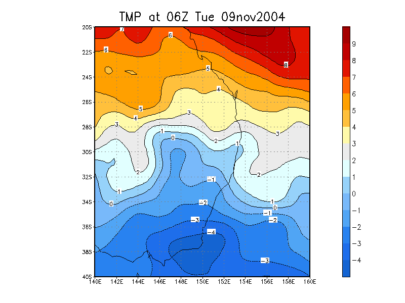
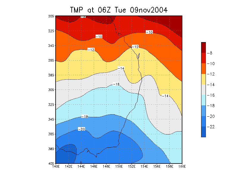
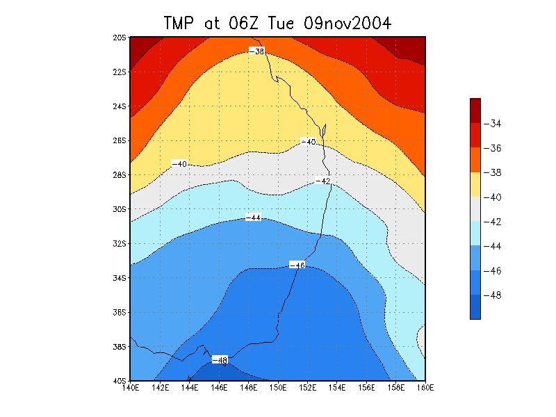
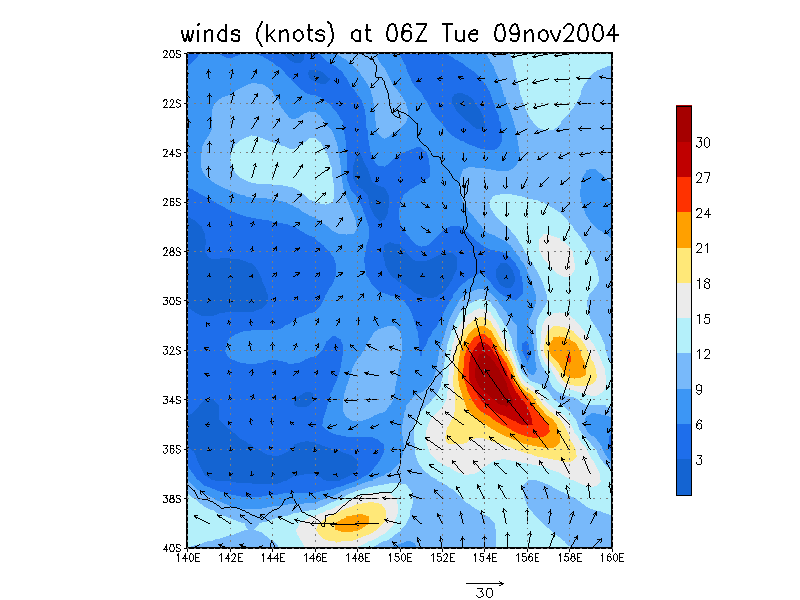
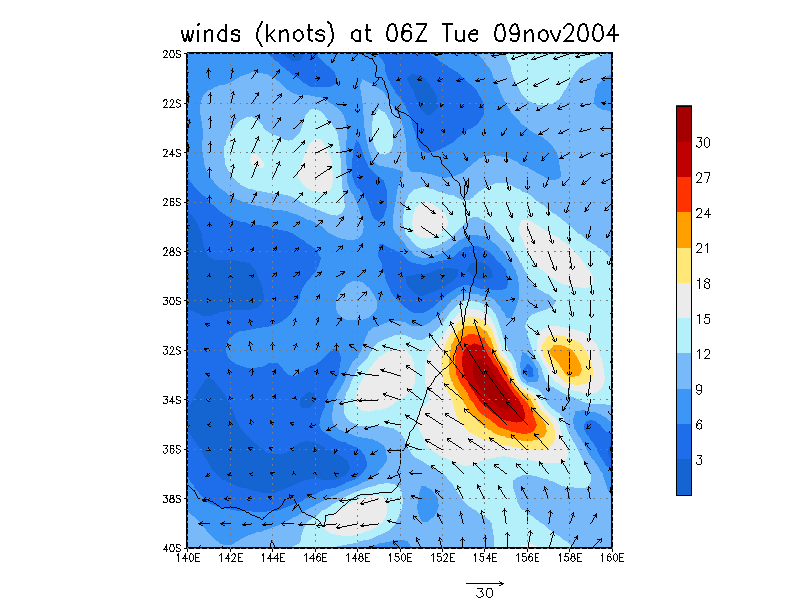
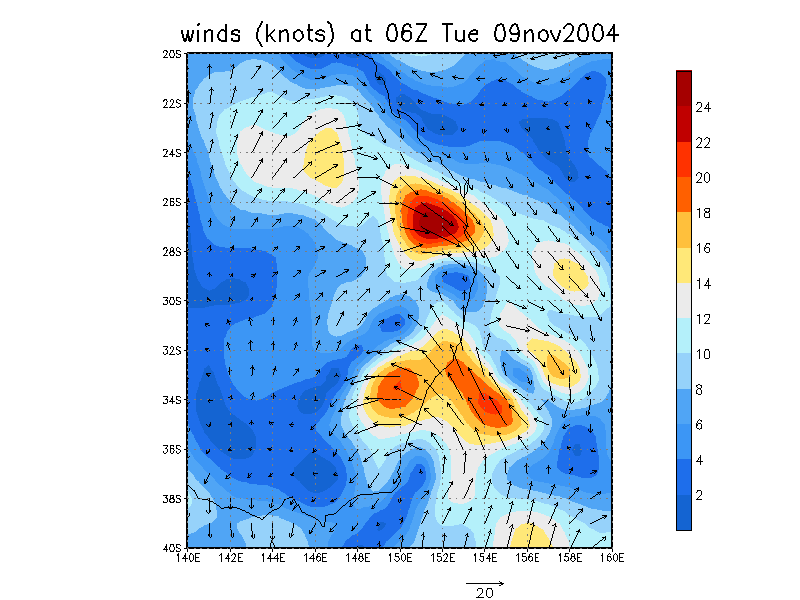
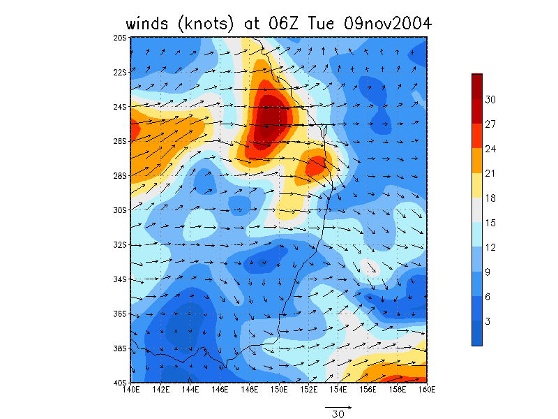
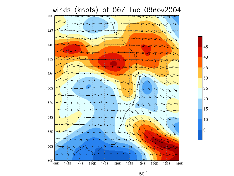
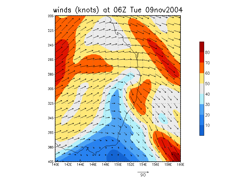
From NOAA 09/11/2004 06z analysis run

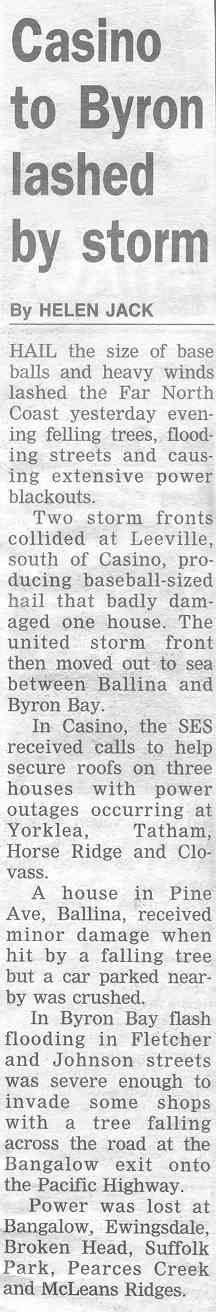
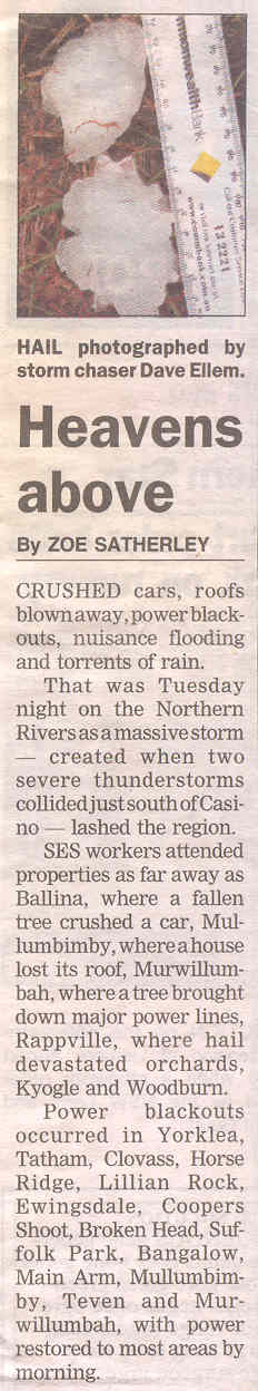
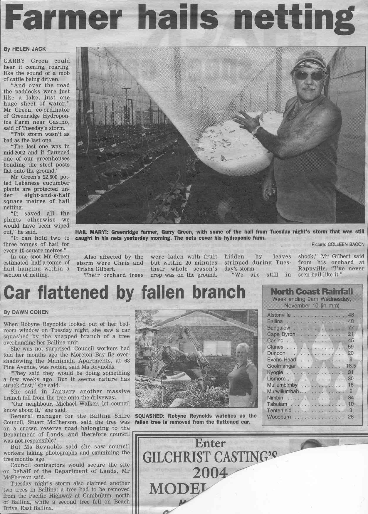
Media Reports
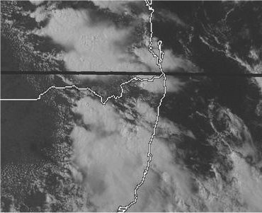
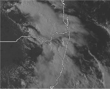
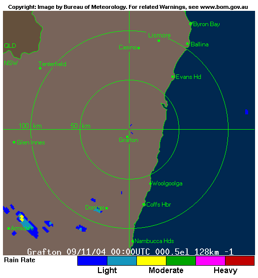
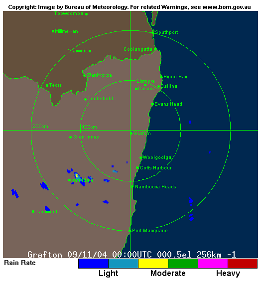
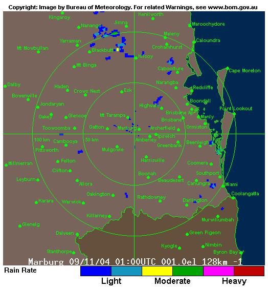
Radar
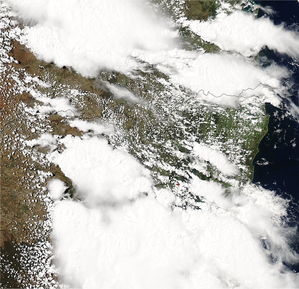
Satellite Images
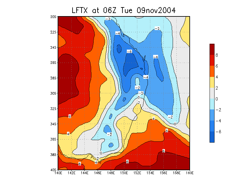
Analysis Chart
GFS Model Analysis
Document: 200411-01.htm
Updated: 1st June, 2005
[Australian Severe Weather index]
[Copyright Notice]
[Email Contacts]
[Search This Site]