and Chasing
[Index][Archives]
Spectacular North Coast Storms: Wednesday 25th October 2000
by Michael Bath
| Storm News and Chasing [Index][Archives] |
Spectacular North Coast Storms: Wednesday 25th October 2000 by Michael Bath |
The day started with a cloud band passing across the northeastern part of NSW from the west. Moderate rain commenced around 7.30am and continued to around 9.30am with about 8mm recorded. The cloud band took until just after noon to clear to the east.
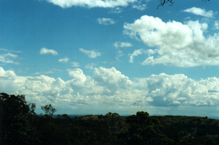
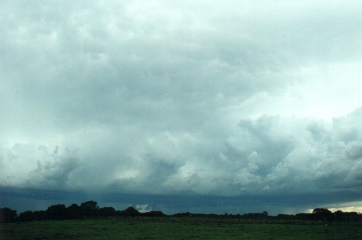
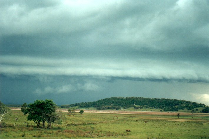
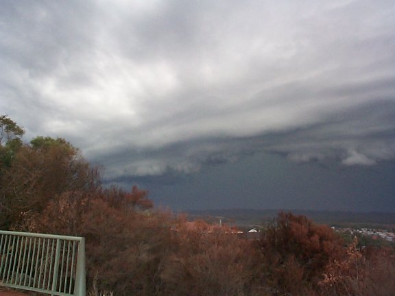
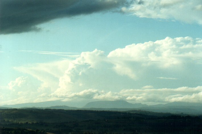
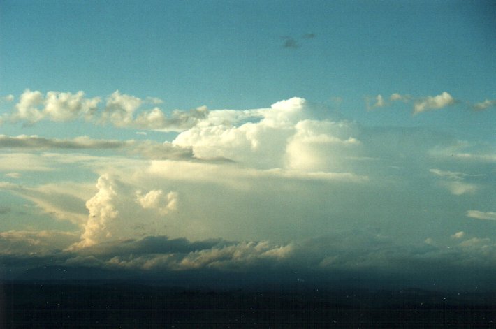
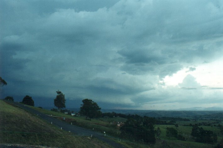
Cumulus soon began forming on the higher terrain to the southwest and west in the humid conditions, though the temperature never got that high, with maximums about 26C in the district. It took until about 2pm until some decent cumulus congestus began to form closer to the coast, though there was plenty on the Northern Tablelands before this. I headed off to my local vantage point at Tregeagle, about 10 kilometres south of my house at McLeans Ridges (and about 5ks SE of Lismore) where the views to the south, southwest and west are uninterrupted. The following photos show initial development along a NNW - SSE line.
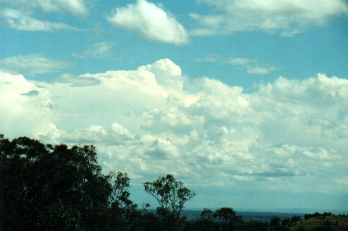
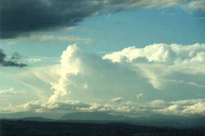
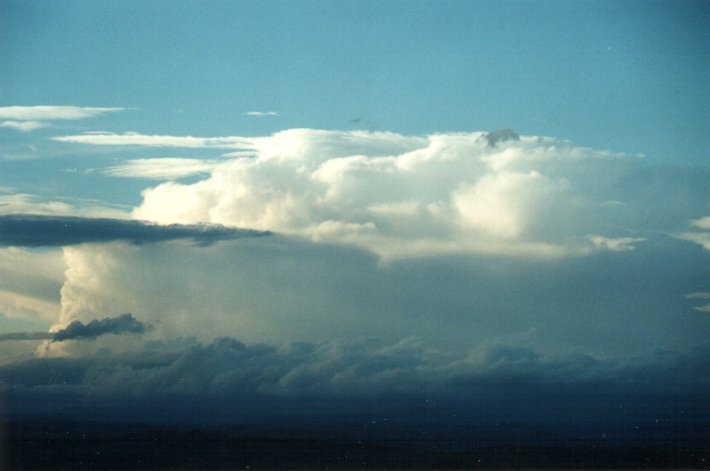
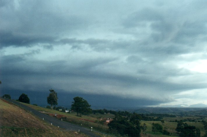
These next two show the slow development between 2.55pm and 3.42pm. There were some storms on the Tablelands spreading eastwards with congestus forming on the leading edge.
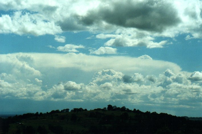
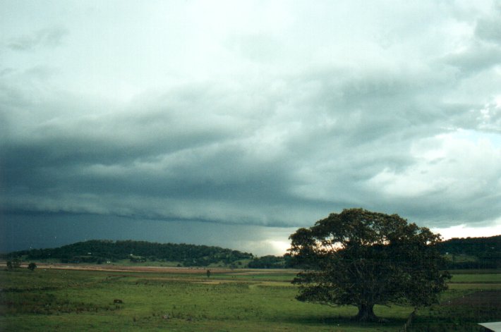
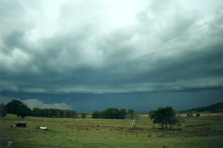
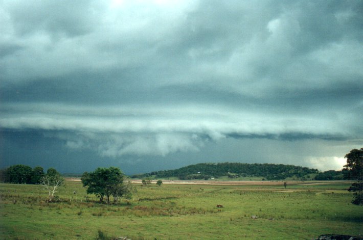
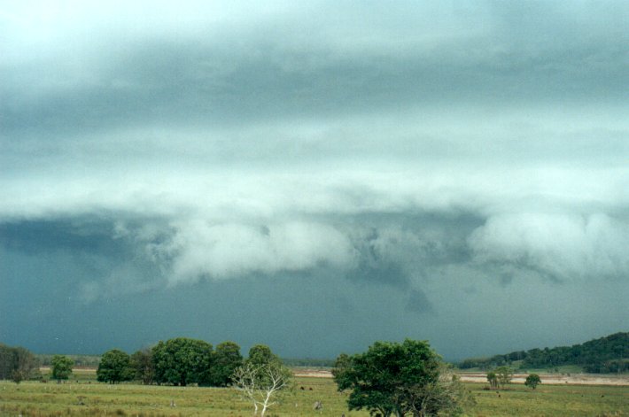
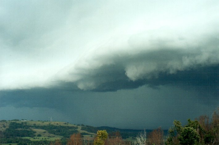
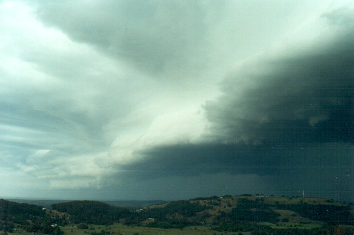
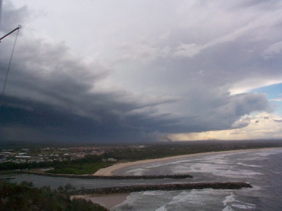
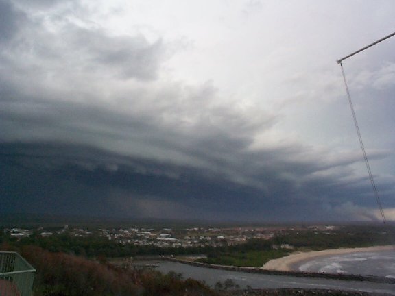
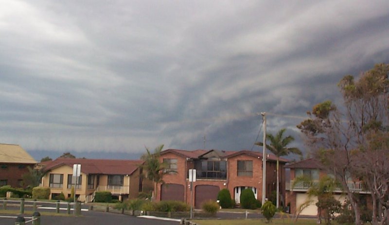
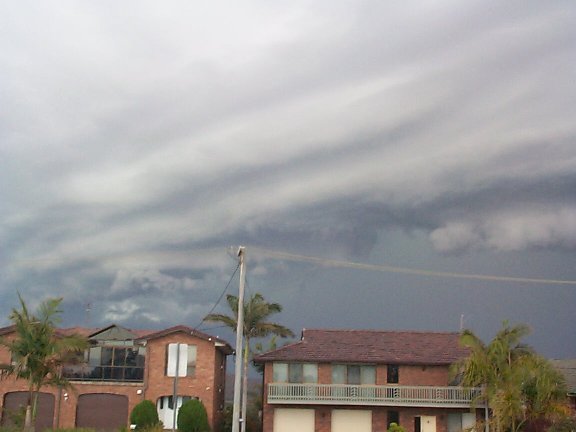
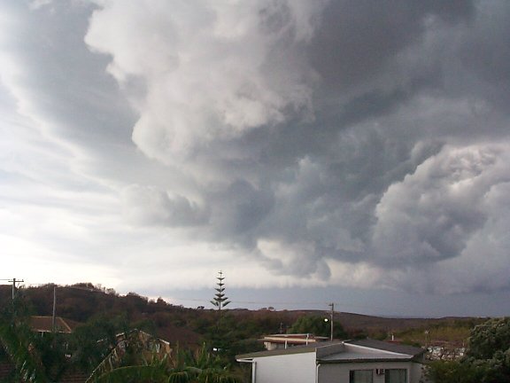
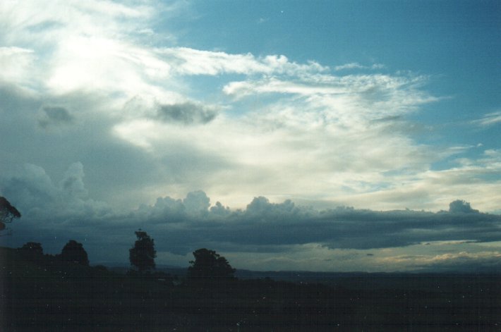
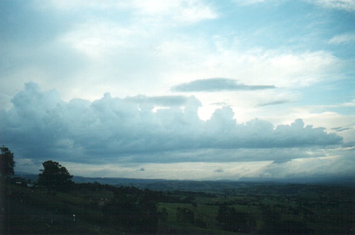
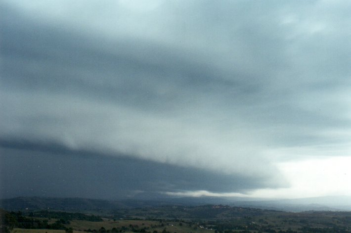
Shortly after this photo was taken I had to return home to attend to the kids until my wife came home from work, then I was off again. In those 40 minutes the storm had developed significantly and was now affacting the Casino area. From radar it was apparent the storm would track in an easterly direction, so I moved to the Meerschaum area south of Alstonville where the plateau falls away to the southern plains. At first I stopped at the top of the hill on the Wardell Road and took some pics facing west. The storm was already developing a significant shelf cloud on the NE inflow region, and this continued to develop over the next 40 minutes or so that I was in position to observe it. These two taken at 4.40pm:
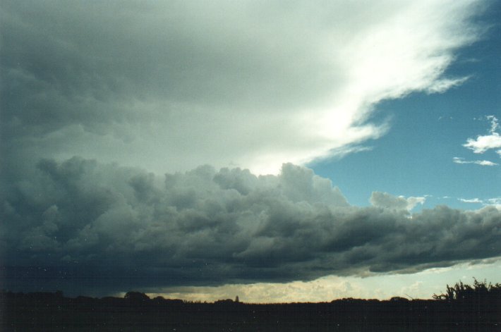
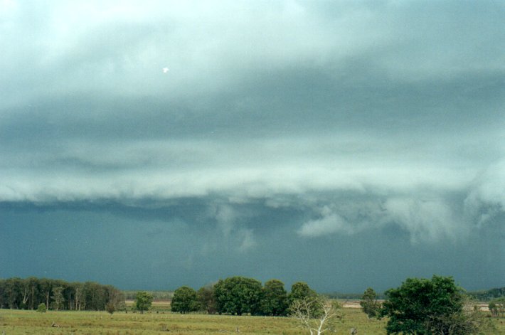
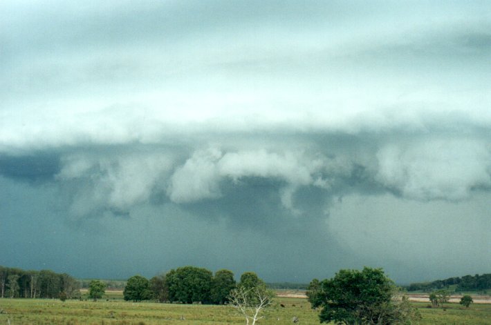
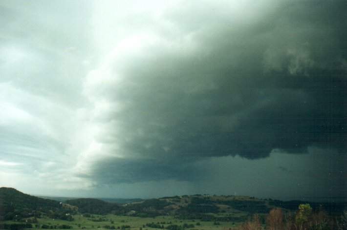
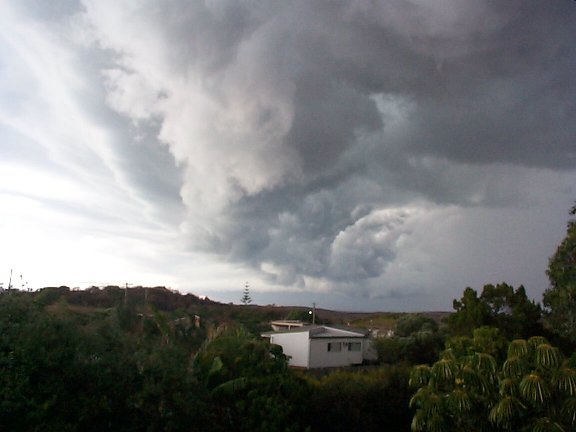
I drove down into the plains where the view to the west in unobscured, positioning myself on the side of a slight rise along the Bagotville Road in Meerschaum Vale.
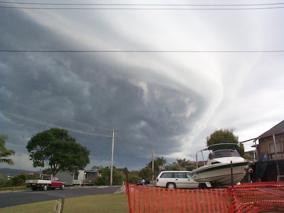
A took many pictures over the next 20 minutes for two reasons: it was so incredibly photogenic; and my video camera batteries were both dead for some unexplained reason !!

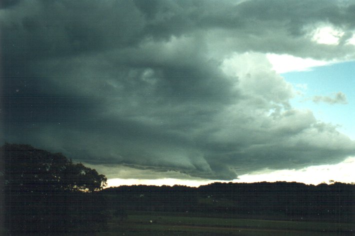
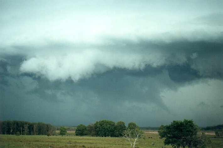
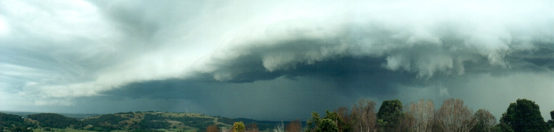
As you can see some amazing lowerings began to develop on the leading edge of the shelf cloud. At this point (5.11pm) I switched from my 35mm wide angle lens (F4 apateur) to my 50mm lens (F1.8 apateur) as the light levels were dropping dramatically and I had no tripod. This allowed some decent panorama shots, though the photo lab still mucked up the brightness somewhat between pics.
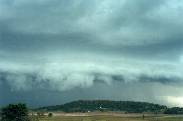

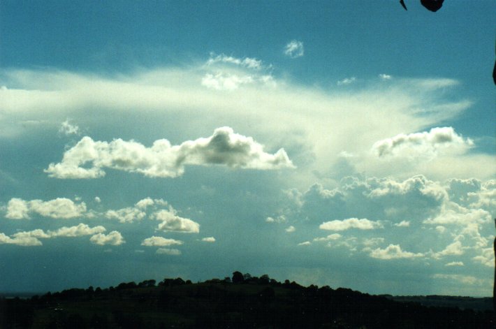
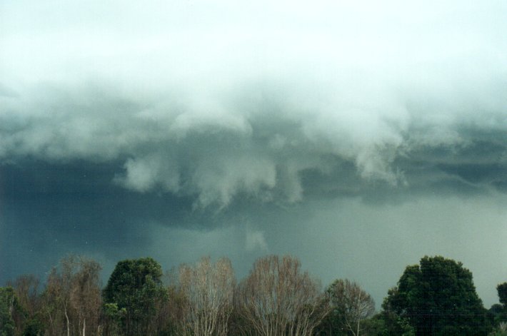
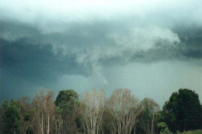
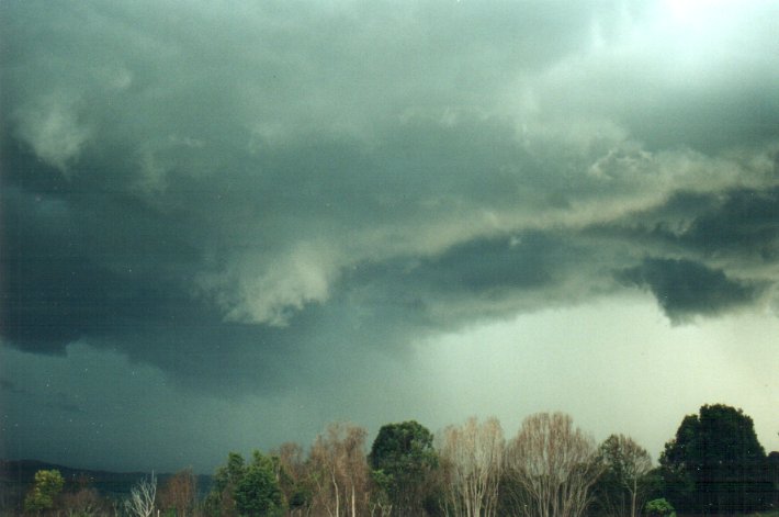
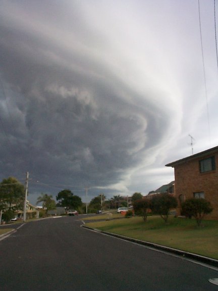
This next sequence over 4 minutes looking WSW is interesting. Quite a dramatic inflow region and funnel shaped formation on the right. This may actually be a wall cloud with tornado, but has occurred in an area with no roads.
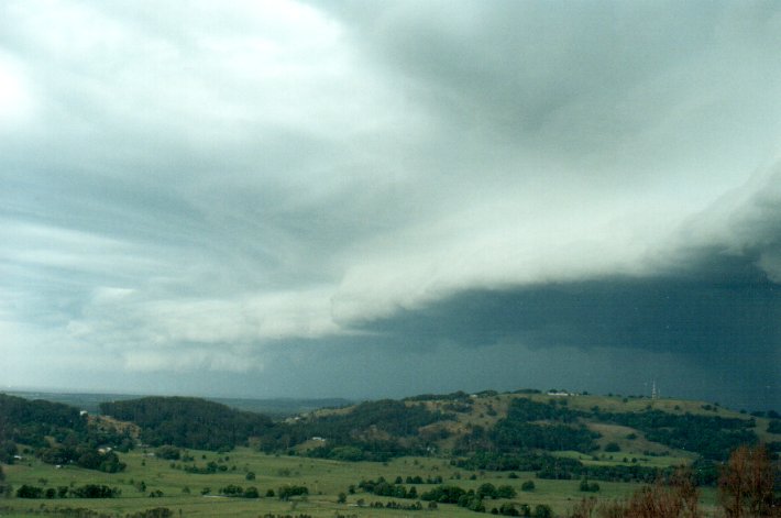
At this point the precipitation was only about 3 kilometres away so I decided to drive back up to the top of Meerschaum Hill to get a better view and to be clear of any wild weather, though as it turns out I was only just clear of it.
Graphic work by Dann Weatherhead
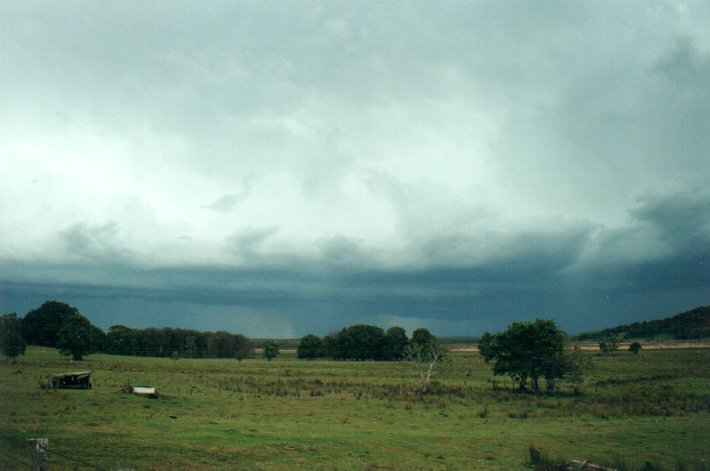
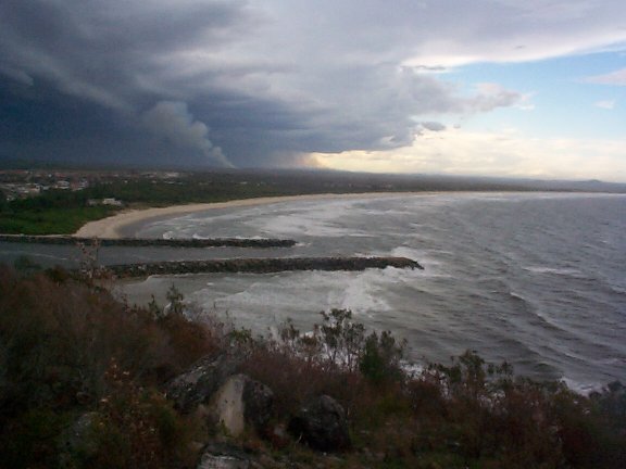
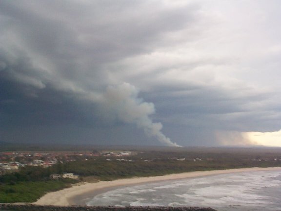
These photos of the same storm were taken from Evans Head by ASWA member Halden Boyd's daughter. Evans Head is approximately 20 kilometres south of Meerschaum where I took my photos.
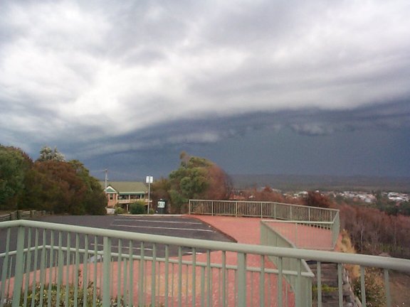
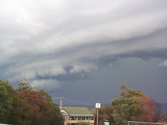
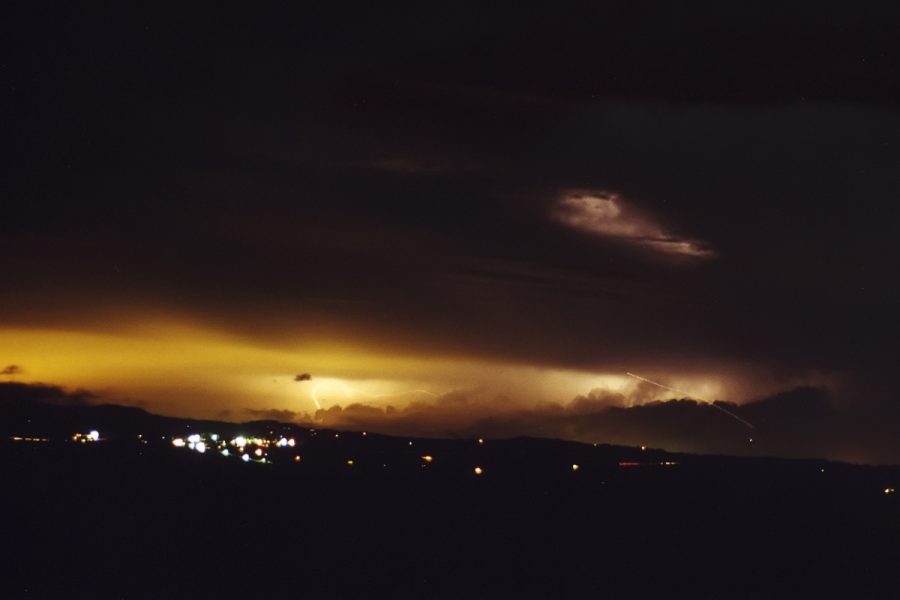
After the excitment of this spectacular shelf cloud, I headed back home as the storm was quickly heading east and would pass out to sea south of Ballina. As soon as I gained a view to the north again it was obvious that powerful storms were occurring along the Border Ranges and in SE QLD, which the Brisbane Storm Chasers were covering. One storm complex in particular developed a powerful new updraft on its rear flank. This storm was near Rathdowney in QLD, about 80km to my north-northwest.
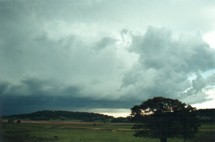
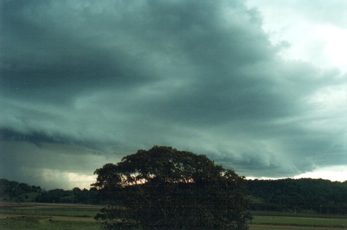
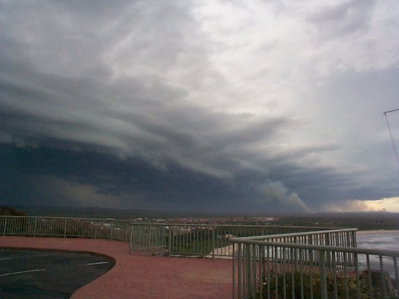
At about the same time it was becoming obvious visually and on radar that further storm activity had developed locally and was heading my way. A line of cumulus very quickly developed into congestus ahead of this new storm stretching to the northeast. This development was a sign that the storm was certainly growing and having seen this a few times before, suspected we'd get a shelf cloud formation as well.
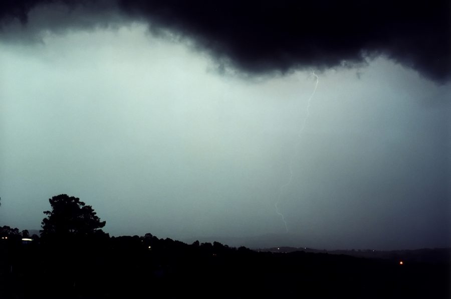
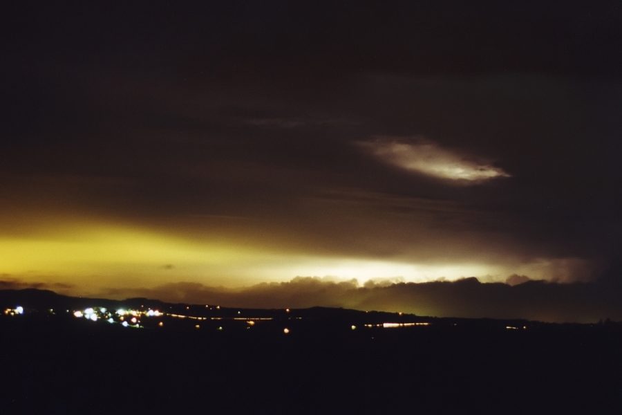
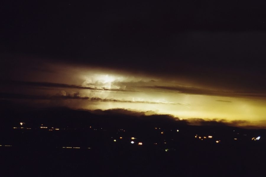
Sure enough a lovely laminar band spread in along the gust front of this new storm. Lightning became frequent and thunder was now audible (7pm). I set the camera on my tripod with the apateur set to F22, and had the camera determine the length of exposure hoping that some lightning may be captured. The formation moved in quite quickly and it was dark by the time it hit, though the frequent lightning kept the sky quite illuminated.
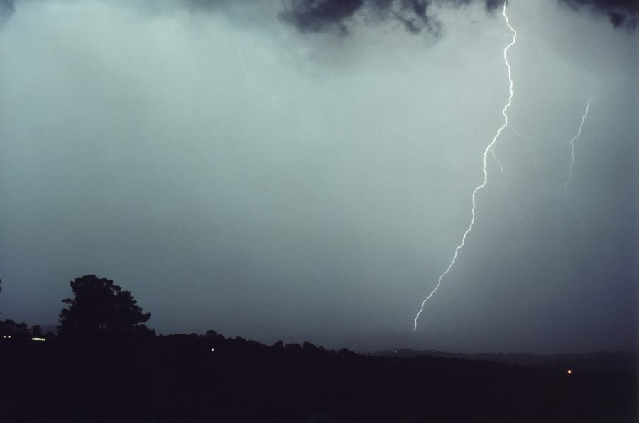
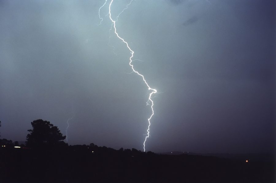
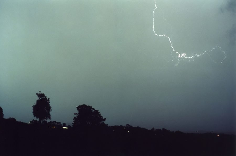
The storm struck our place at about 7.30pm with only moderate rainfall (5mm in about 20 minutes) and some strong winds, which was a surprise after watching it move in, as it looked like much stronger winds and heavier rain, and possibly hail would occur. After some persistent rain cleared I took a few pics of the storm moving out to the east.
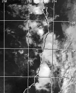
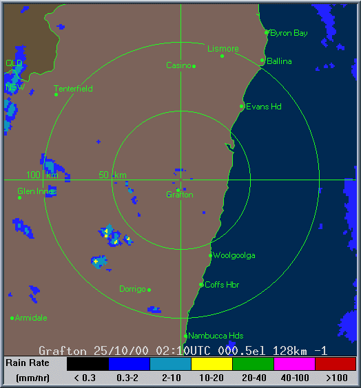
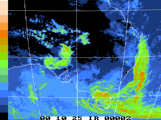
These images from Bureau of Meteorology
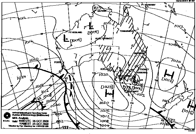
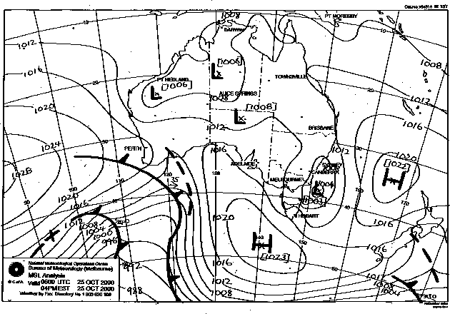
These images obtained from Bureau of Meteorology.
|
Document: 0010-04.html
Updated: 3rd October, 2005 |
[Australian Severe Weather index] [Copyright Notice] [Email Contacts] [Search This Site] |