and Chasing
[Index][Archives]
Severe Thunderstorm Images of the Month Archives - 2005
Other years: [1997][1998][1999][2000][2001][2002][2003][2004][2005][2006][2007][2008][2009][2010]
| Storm News and Chasing [Index][Archives] |
Severe Thunderstorm Images of the Month Archives - 2005 Other years: [1997][1998][1999][2000][2001][2002][2003][2004][2005][2006][2007][2008][2009][2010] |
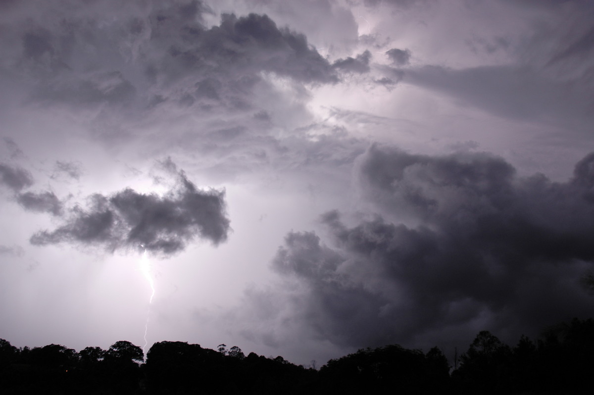
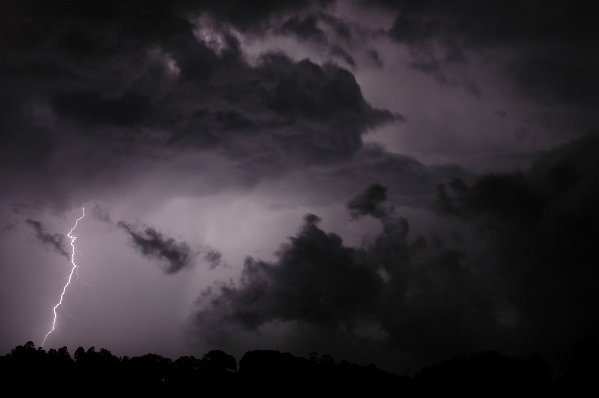
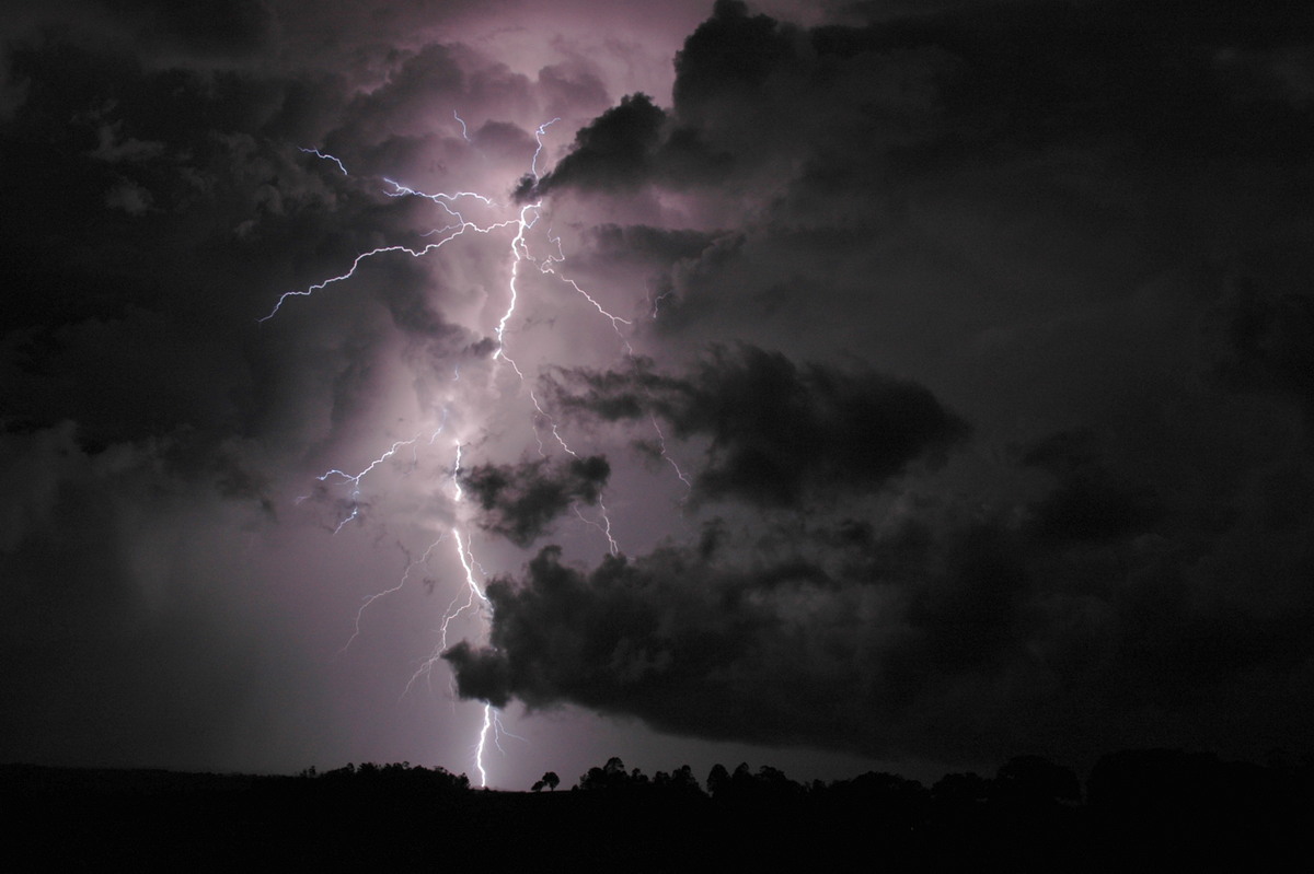
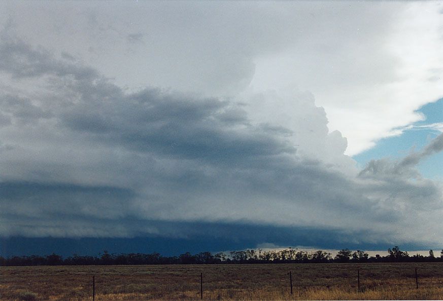
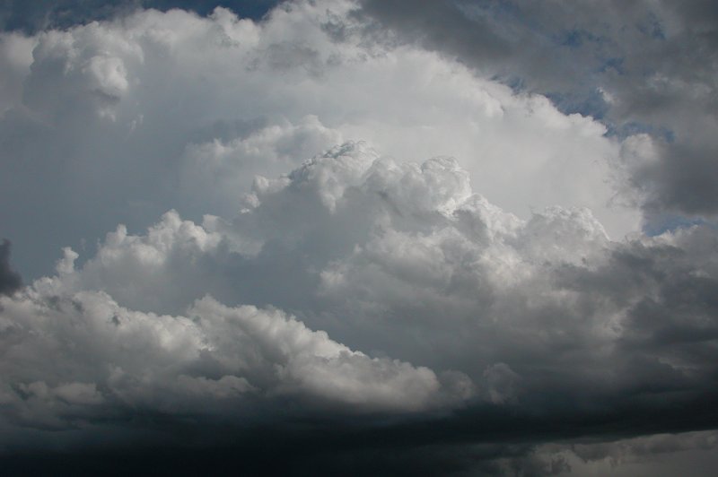
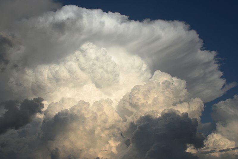
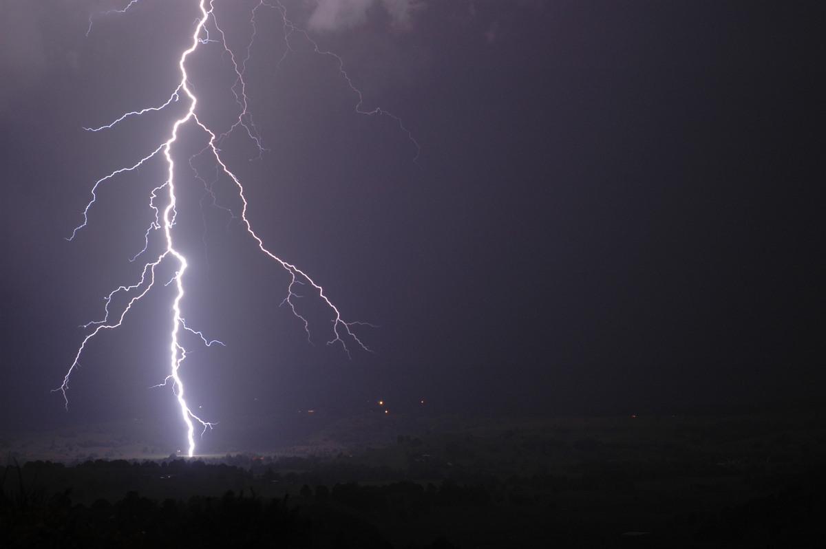
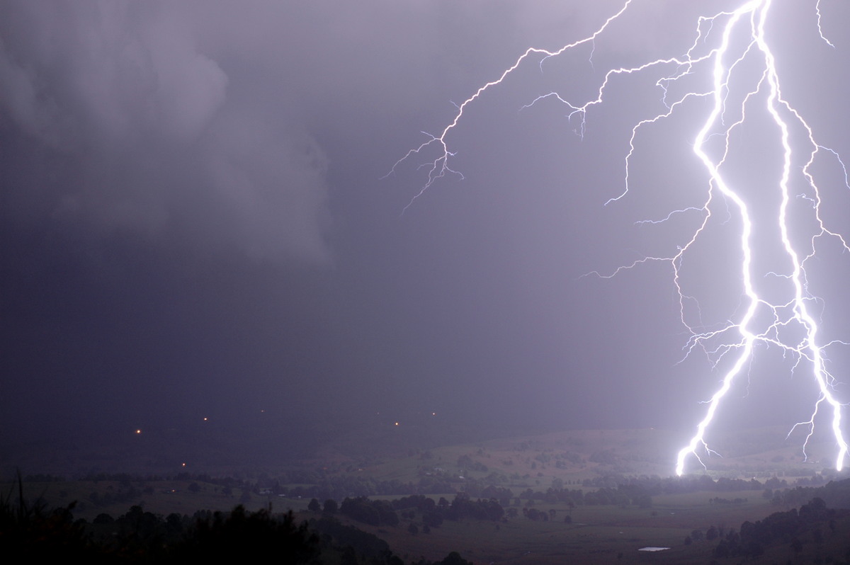
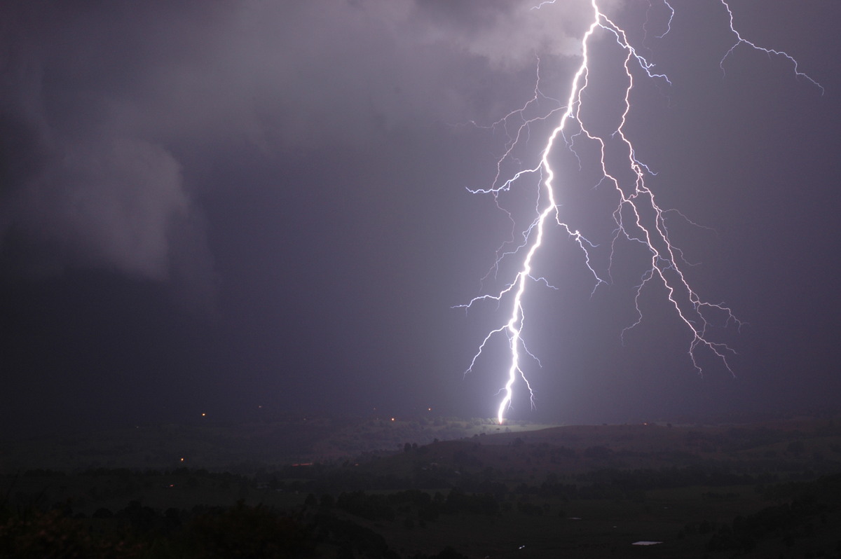
| Severe Thunder- storm images of the month: December 2005
Photographs by Jimmy Deguara |
|
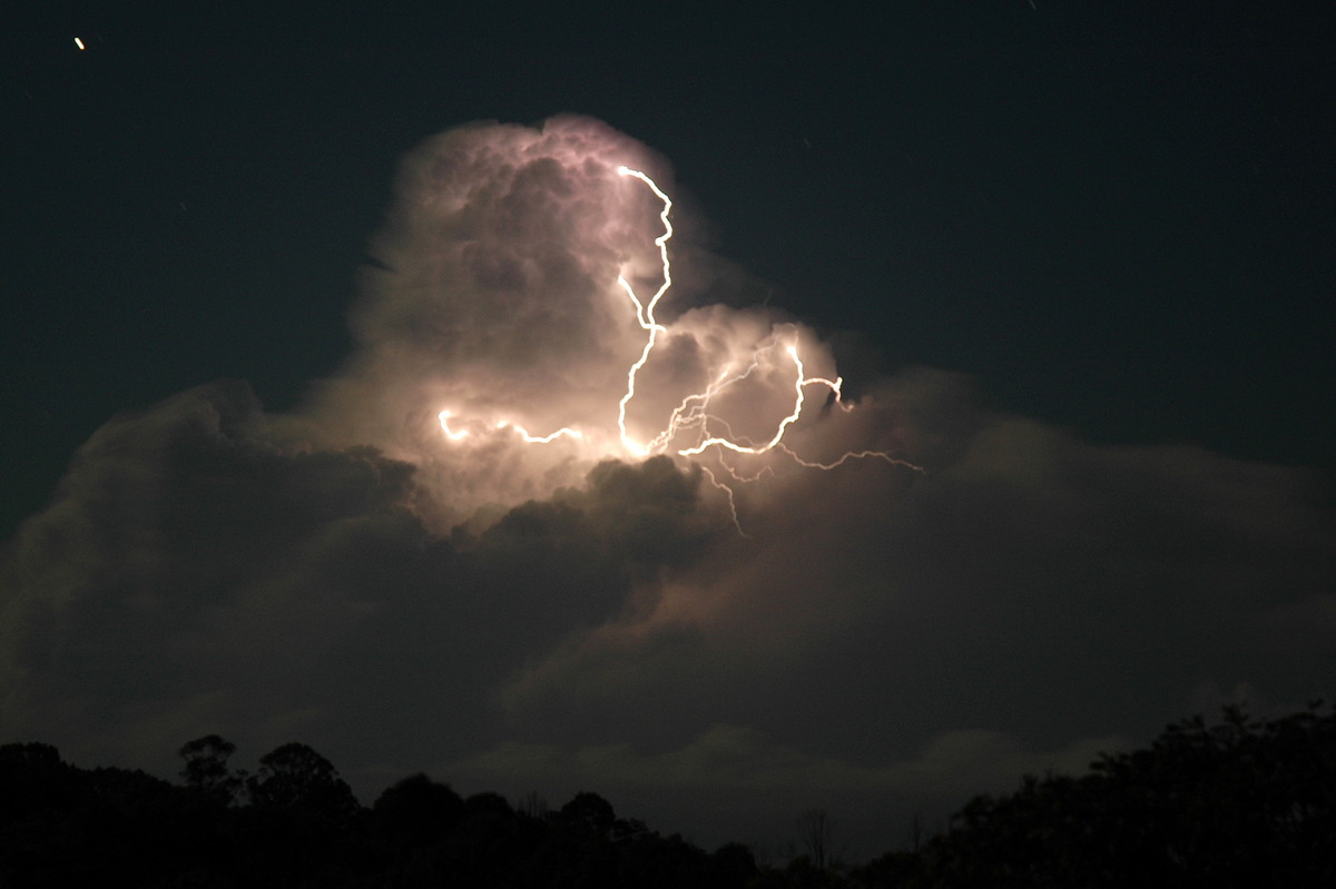
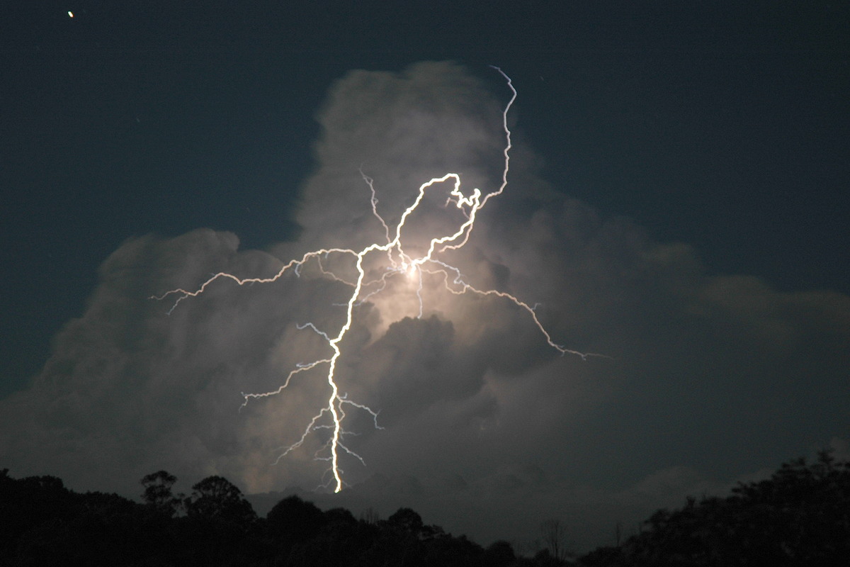
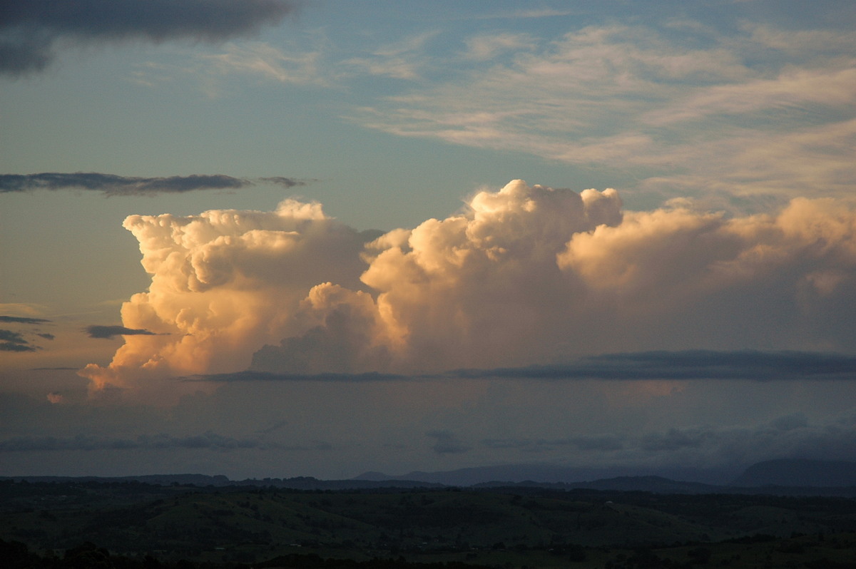
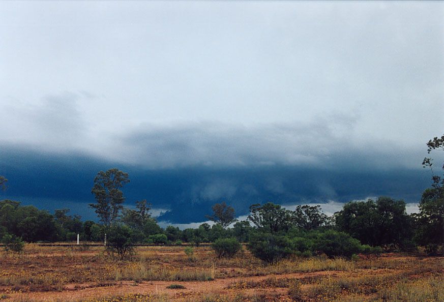
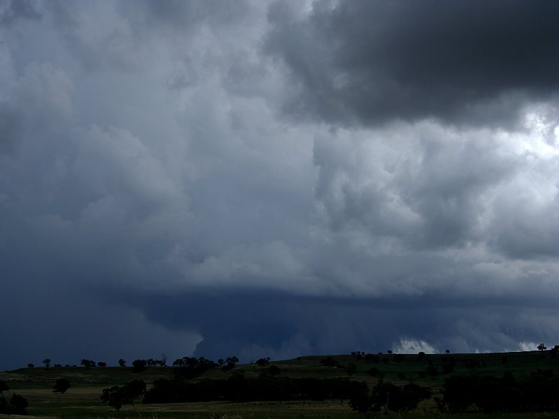
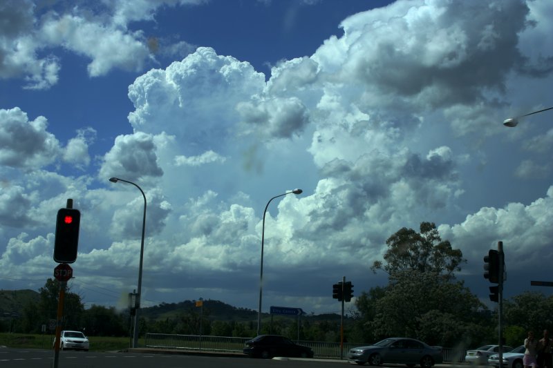
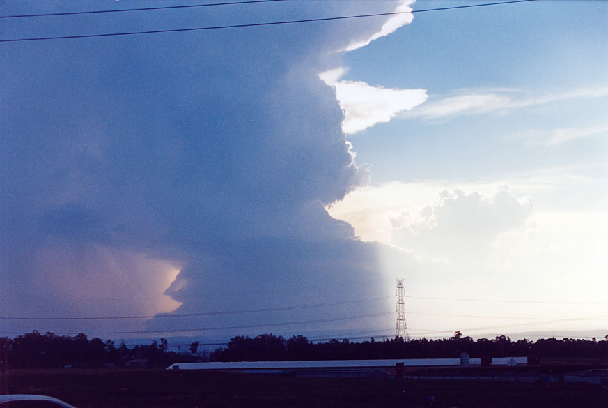
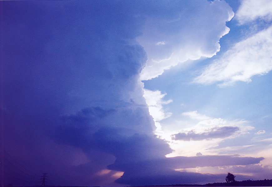
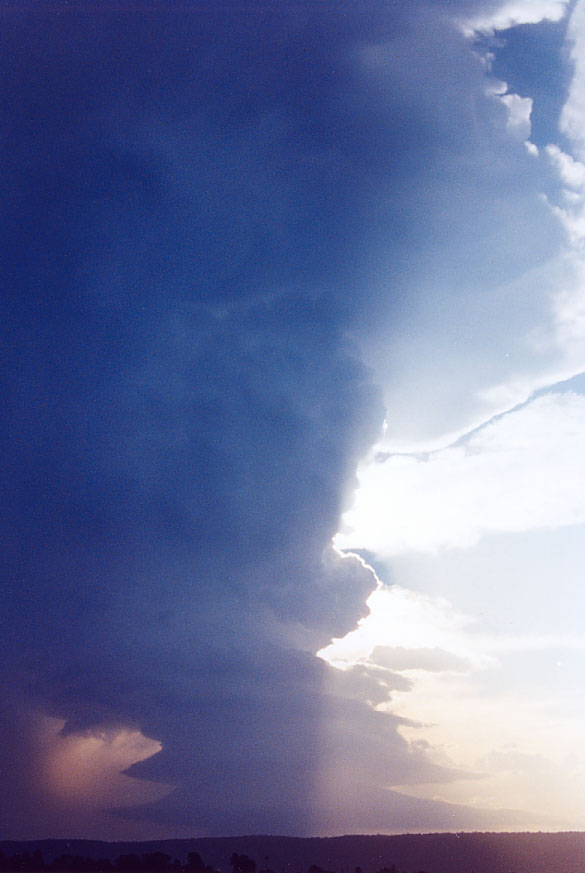
| Severe Thunder- storm images of the month: November 2005 Photographs by Jimmy Deguara |
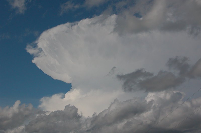
Meanwhile, moisture invasion of the southern parts of the Northern Tablelands
created an ideal environment for rapid development of thunderstorms. Some
incredible updrafts were observed - one updraft in particular accelerated rapidly to create a knuckle formation of the updraft.
Check the chase report more of these spectacular shots.
|
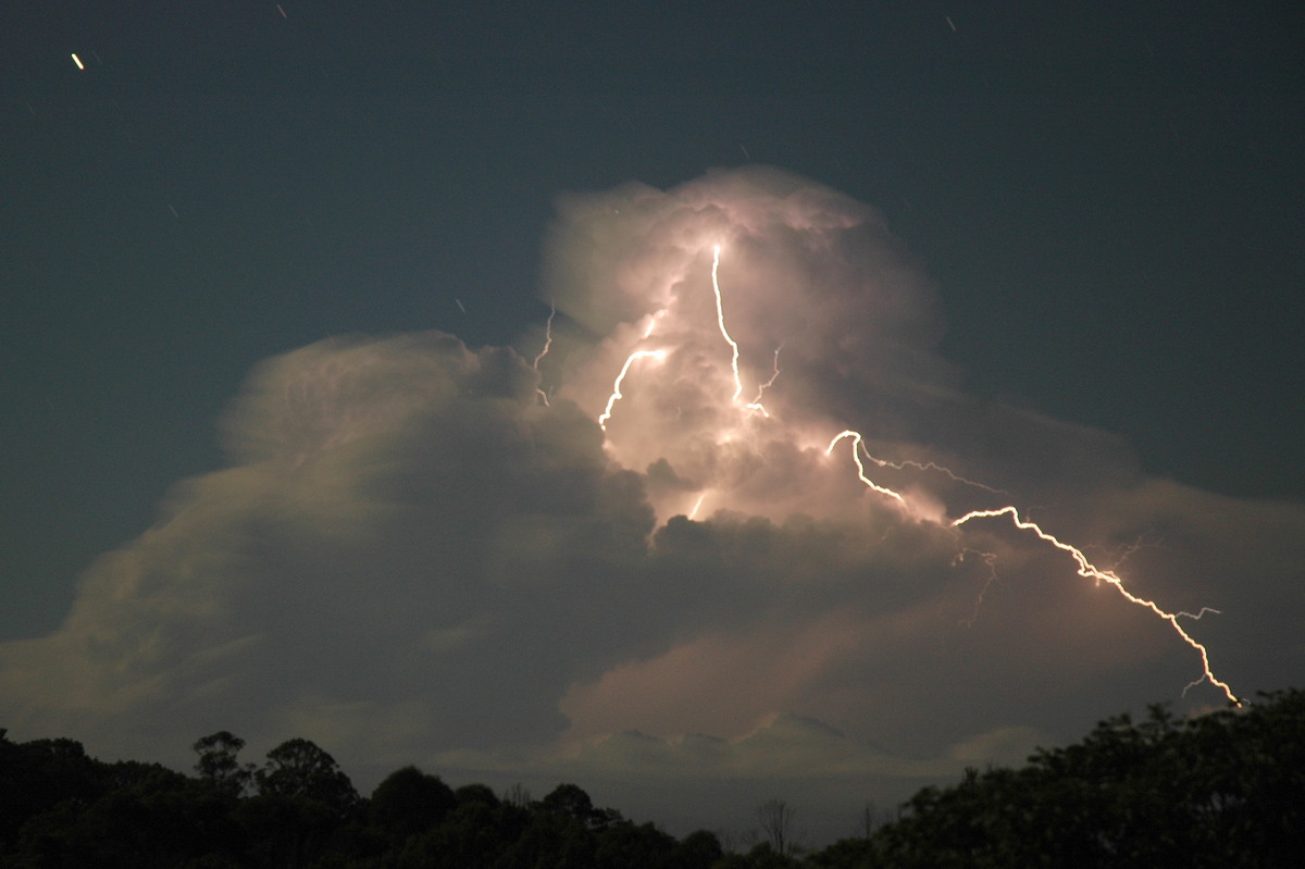
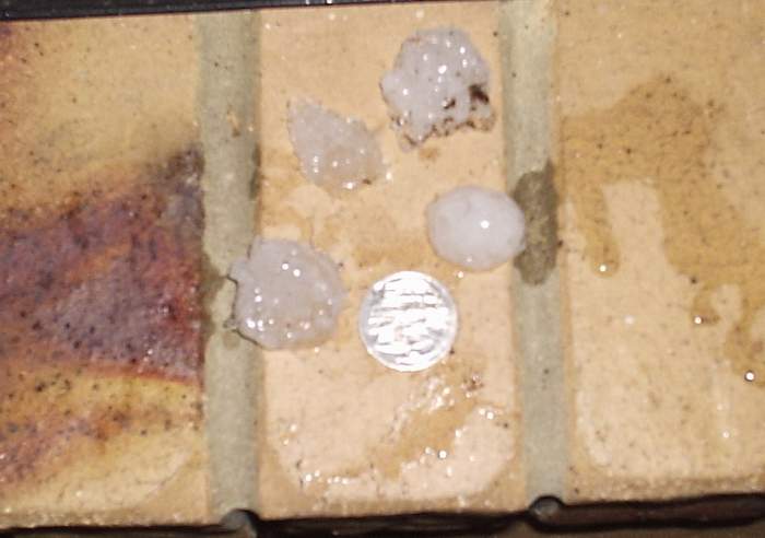
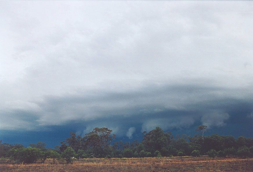
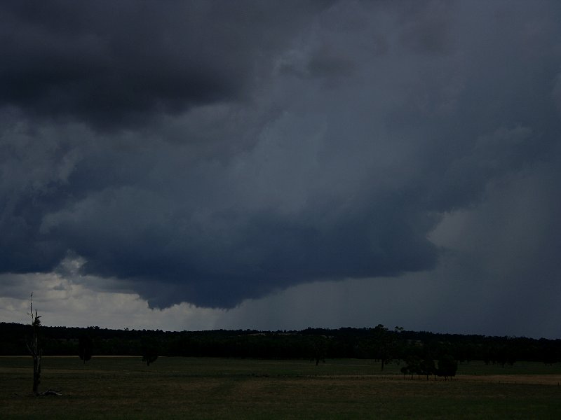
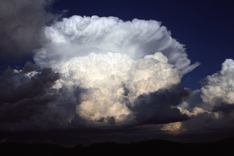
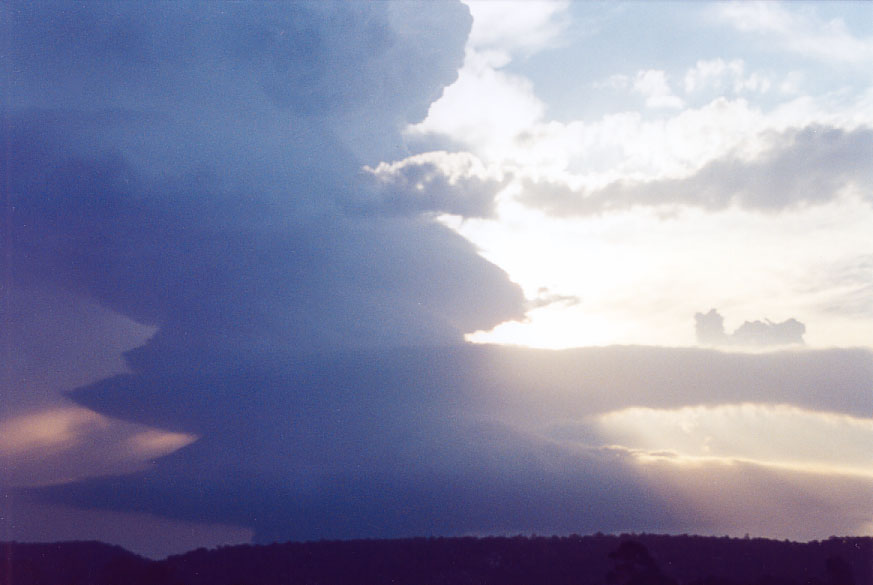
| Severe Thunder- storm images of the month: October 2005
Photographs by Michael Bath |
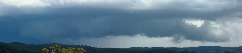
Incidentally, these
storms were severe producing large hail and damaging winds. Damage was reported
just south of Michael's location.
Check the chase report more of these spectacular shots.
|
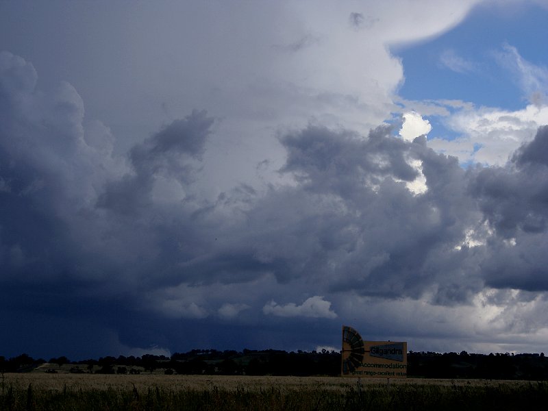
| Severe Thunder- storm images of the month: September 2005 Photographs by Jimmy Deguara |
|
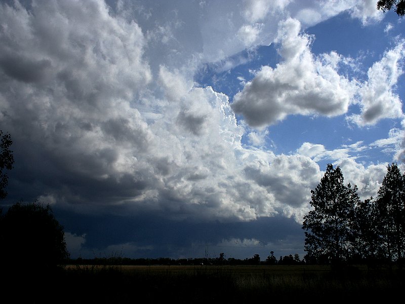
| Severe Thunder- storm images of the month: August 2005 Photographs by Jimmy Deguara |
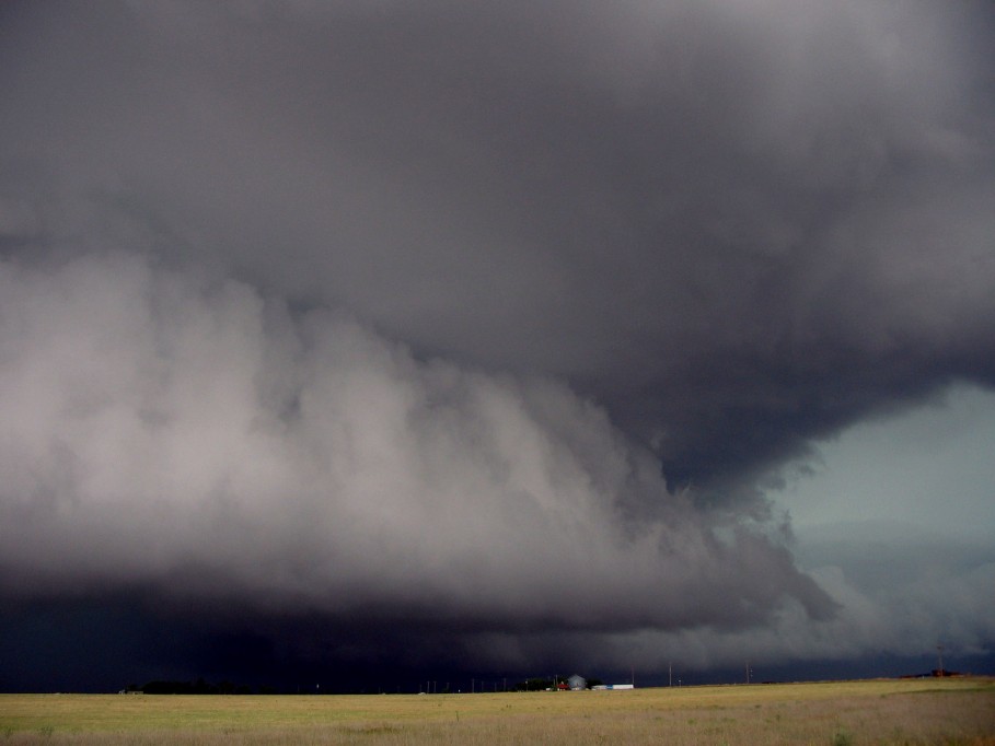
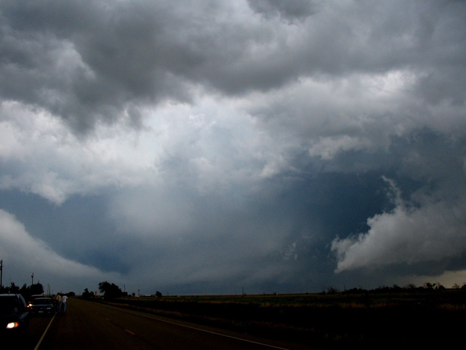
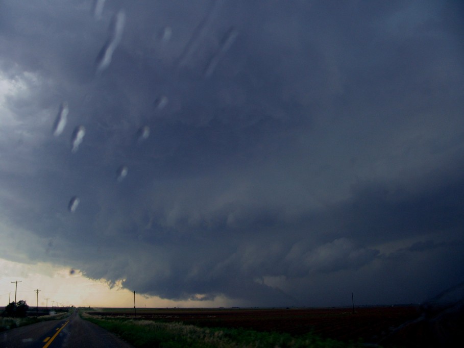
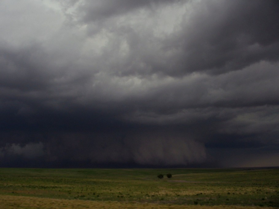
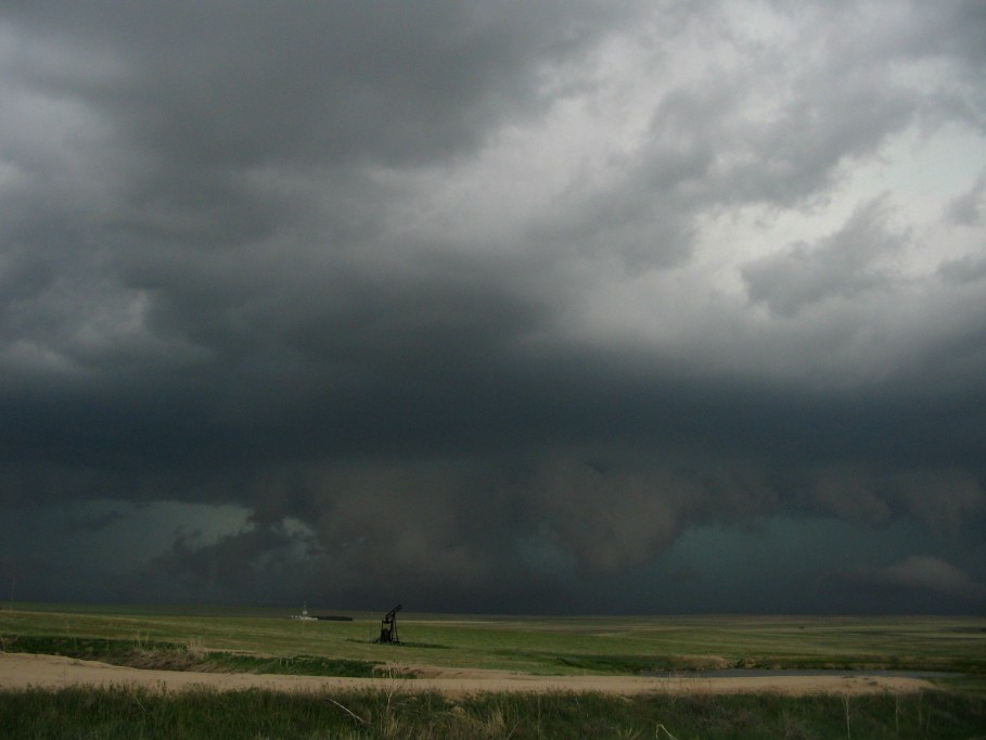
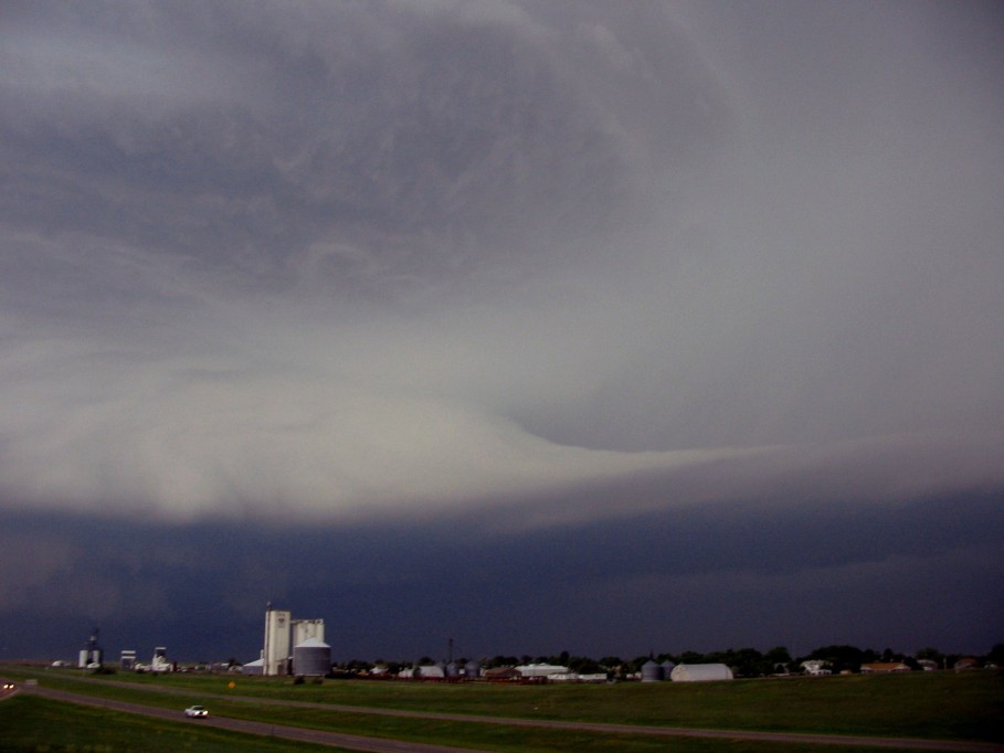
There is one wish a chaser has each year:
to be able to chase the magnificent Texas Panhandle. On 31st May 2005, this vast elevated plain produced
a severe weather setup with once again particlarly large hail from monster HP supercells. At one stage,
we were treated to a beautiful, barrel updraft.
This dangerous storm eventually weakened and dissipated whilst
another supercell was spawned to its west.
This storm traversed Lubbock causing extensive damage and flash
flooding.
At one stage, three tornado warnings werein effect in the region near Lubbock. The city had experienced
early morning flashflooding and large hail from the remnance of previous convection drifting overnight from New Mexico.
One always wanders what may be happening in another supercell cluster - apparently tornado reports there as well.
|
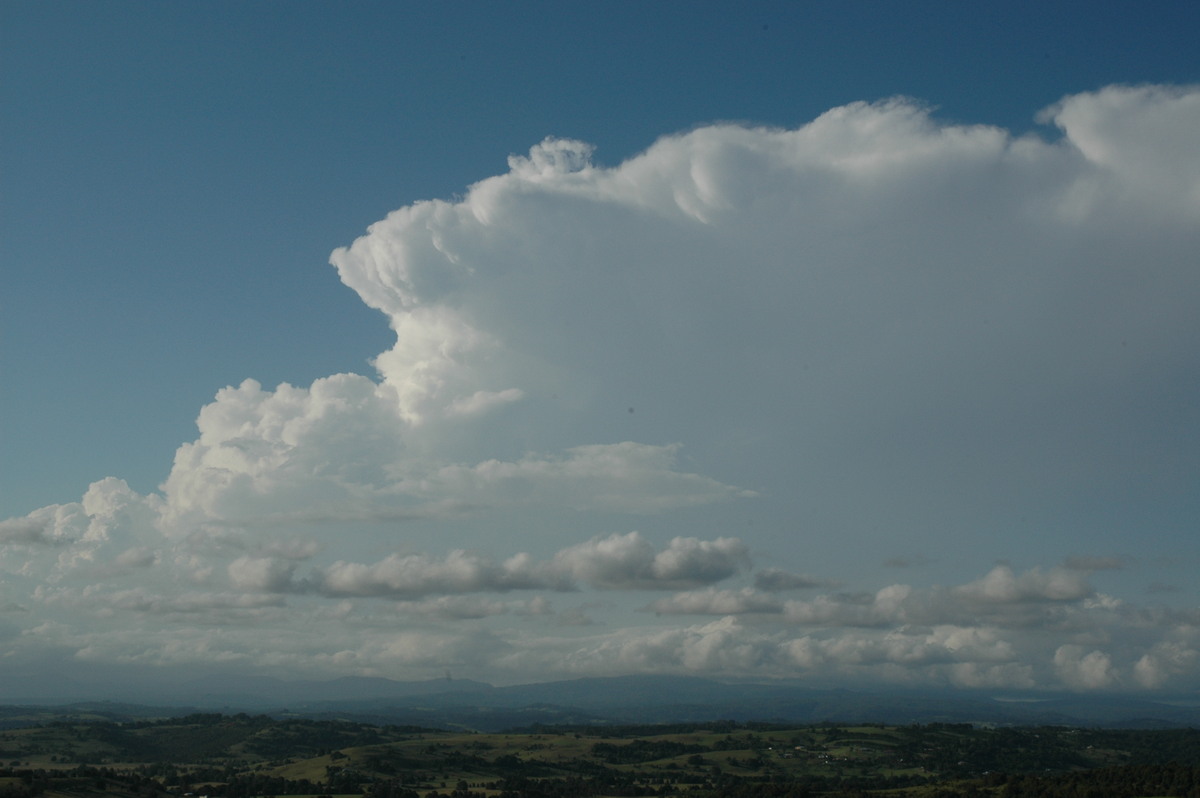
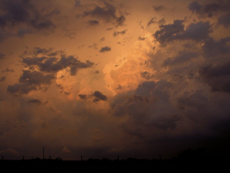
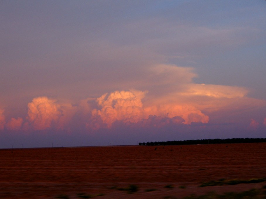
| Severe Thunder- storm images of the month: July 2005 Photographs by Jimmy Deguara |
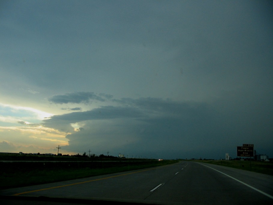
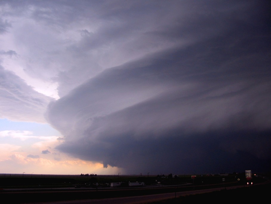
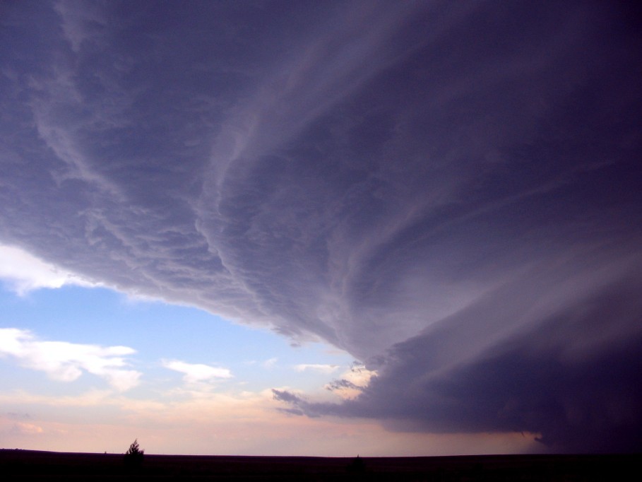
Colorado is renowned
for its magical storm structures. The first storm on June 2 2005 would make any
mouth water. It was tornado warned and exhibited a spectacular gust front
formation. A tornado was apparently observed with this storm!
But the storm to its immediate southwest was about to pound Limon. Approaching
from the east unveiled a mean, sculptured HP beast complete with striations and
inverted wedding cake structure. In fact it contained a detached ring imitating the
Rings of Saturn!
In addition to the tornado warning, hail to grape fruit was already being
reported in the community of Limon. The obvious casualties were cars, house
roofs and windows. Paralleling the interstate, a large tornado was observed in
the storm further east. The whole complex of supercells merged into an MCC (Mesoscale
convective complex). This storm would remain the favourite for my 2005 chase
vacation.
|
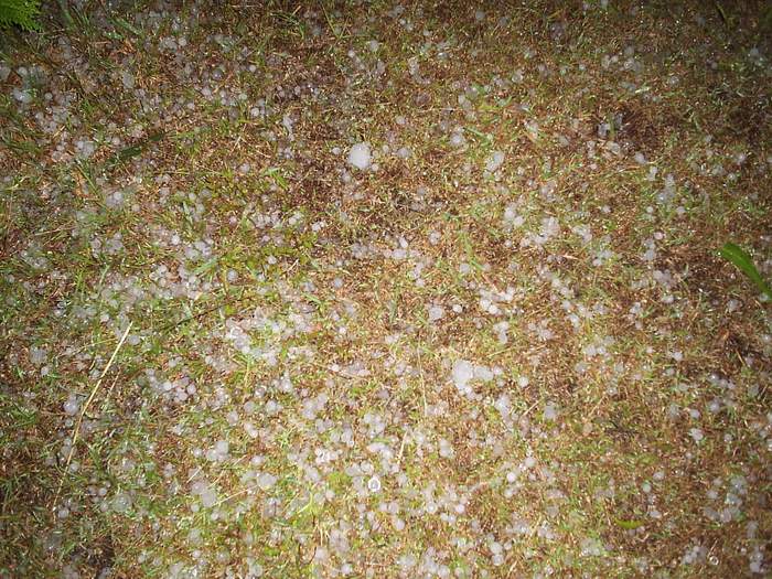
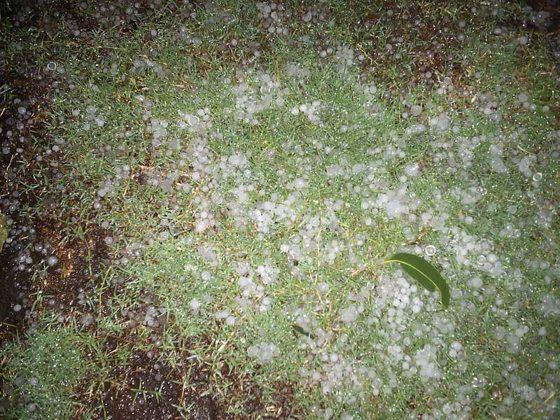
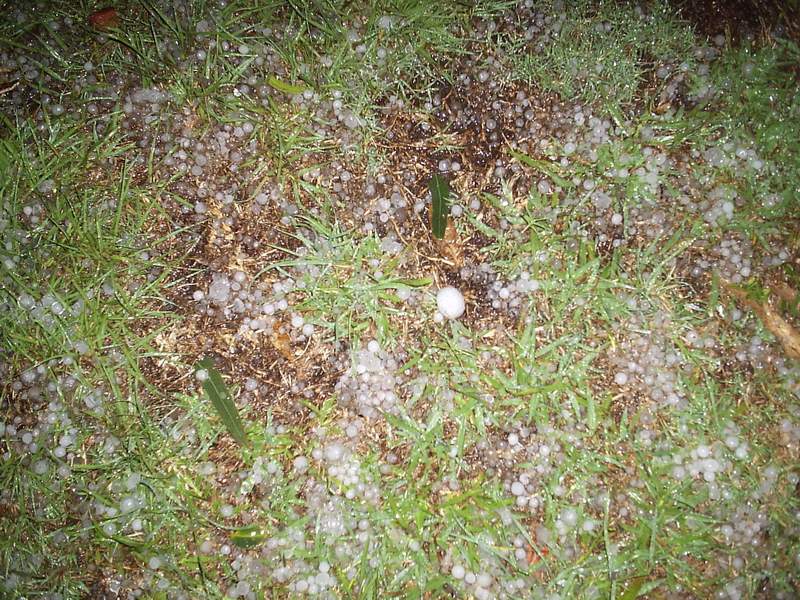
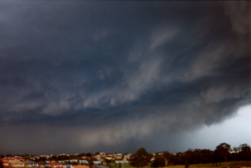
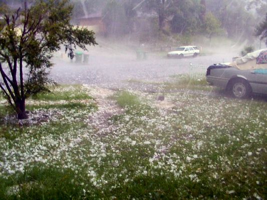
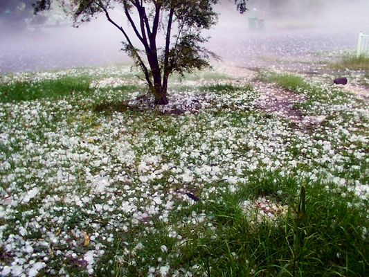
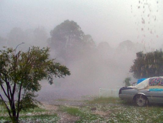
| Severe Thunder- storm images of the month: June 2005 Photographs by Jimmy Deguara, Richard Davis and |
A High Precipitation (HP) supercell developed and moved through the Sydney suburbs dropping violent winds and very large hailstones on Wednesday 2nd February 2005. A possible weak tornado at North Ryde is being investigated.
The Central Coast supercell also dumped very large hail that damaged cars and broke windows. Both storms were labelled as dangerous with the upgraded BoM warning.
|
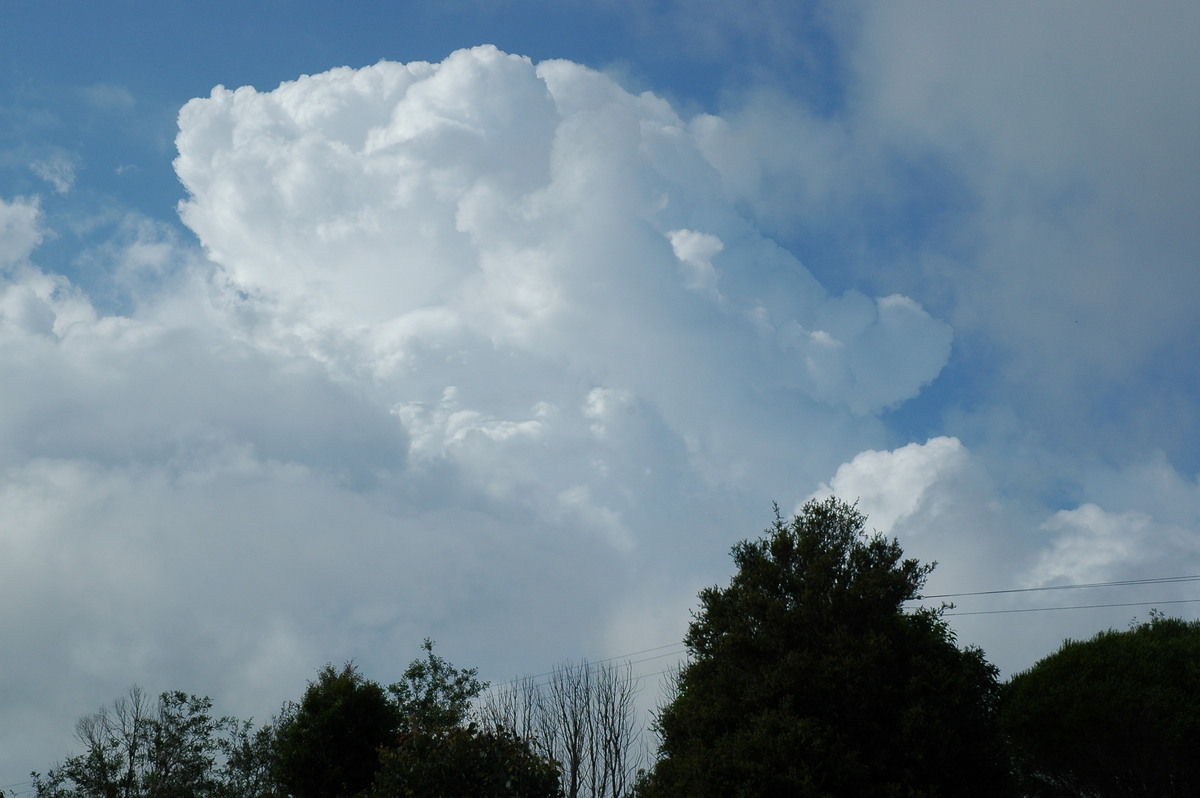
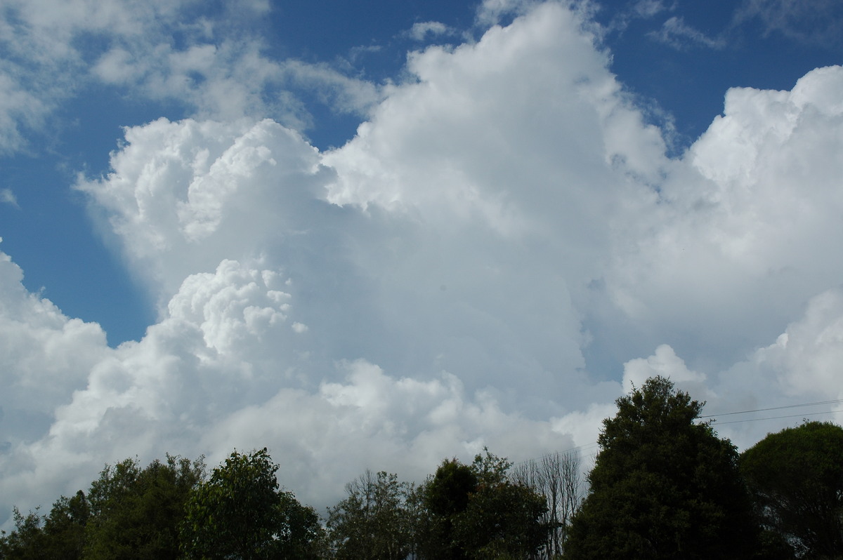
| Severe Thunder- storm images of the month: May 2005 Photographs by Michael Bath |
Some NNW moving storm cells developed between Ballina and Evans Head from about 8am on 20th April 2005. The first thunderstorms were smaller and tracked mainly between Ballina and Alstonville.
However a larger slow moving system consisting of multiple cells formed near Ballina and tracked over and mainly west of Byron Bay early afternoon.
Byron Bay recorded 122mm between noon and 3pm, while the nearby Belongil AWS recorded 104mm, 76mm of which fell in the hour to 3pm. Fernleigh about 10km to the west recorded 80mm during the event.
|
| Severe Thunder- storm images of the month: April 2005 Photographs by Michael Bath and Maraie Halstead |
Some weak thunderstorms persisted in the Northern Rivers during the afternoon and evening of 22nd March 2005. A few cells formed off the Tweed Coast during the evening but were only giving off dull infrequent in-cloud lightning at first. However, a new updraft on a storm off Byron pushed a little higher and gave a barrage of clear-air CGs over 5 minutes. These were taken about 10.40pm from McLeans Ridges.
Meanwhile, a more organised storm formed on the Richmond Range west of Casino around 11pm. This tracked generally eastwards hitting Casino with hail to 4cm diameter and strong winds just after midnight. Small hail was also reported at Tregeagle. Maraie Halstead took these images just after the hail fell in Casino.
|
| Severe Thunder- storm images of the month: March 2005 Photographs by Michael Bath |
Some thunderstorm activity developed in the north of the Northern Rivers region during late afternoon on 17th February 2005. A multicell persisted in the Tweed for a while before dissipating. Further activity formed along the Queensland border towards sunset.
A very slow moving complex of storms passed through the Ballina to Byron areas mid to late evening. Lightning was frequent but mostly in-cloud.
|
| Severe Thunder- storm images of the month: February 2005 Photographs by Jimmy Deguara |
|
| Severe Thunder- storm images of the month: January 2005 Photographs by Dave Ellem and Michael Bath |
Conditions on 9th November 2004 were ideal for supercells to develop if storm activity established in the Northern Rivers. Early thunderstorms formed to the north and south of the area which often happens - but can be initially off putting to storm chasers ! Dave Ellem and Michael Bath headed west about 1.30pm to watch initial development between the Great Divide and Richmond Range west of Casino. Weak multicellular development to the SW gathered strength suddenly after 3.30pm. Another storm with explosive updrafts formed to the north.
For more details see the chase report
|
|
Document: arc2005.htm
Updated: 3rd February 2006 |
[Australian Severe Weather index] [Copyright Notice] [Email Contacts] [Search This Site] |
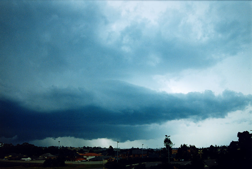
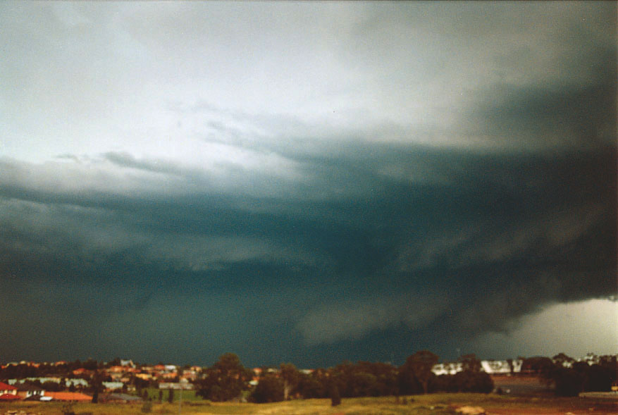


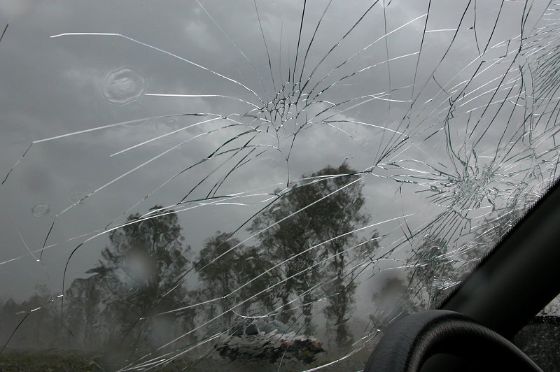
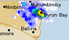 The storms were not lightning active but produced some flash flooding and strong wind gusts. The Bureau of Meteorology issued a severe thunderstorm advice for the storm depicted in this radar image at 2.20pm. A wind gust of 102km/h had been recorded at Cape Byron shortly before the warning was issued.