and Chasing
[Index][Archives]
Southeast Queensland Severe Storm Outbreak: 22nd November 1999
by Jimmy Deguara
| Storm News and Chasing [Index][Archives] |
Southeast Queensland Severe Storm Outbreak: 22nd November 1999 by Jimmy Deguara |
Check the video file within the report below in the appropriate section.
It was the third day of the Australian Severe Weather Association (ASWA) End-Of-Year-Chase. We had followed the trough line on the previous day east to Roma. There were some interesting thunderstorms to our south including a supercell that had destroyed 800 hectares of crops around 200 kilometres to the south at St George.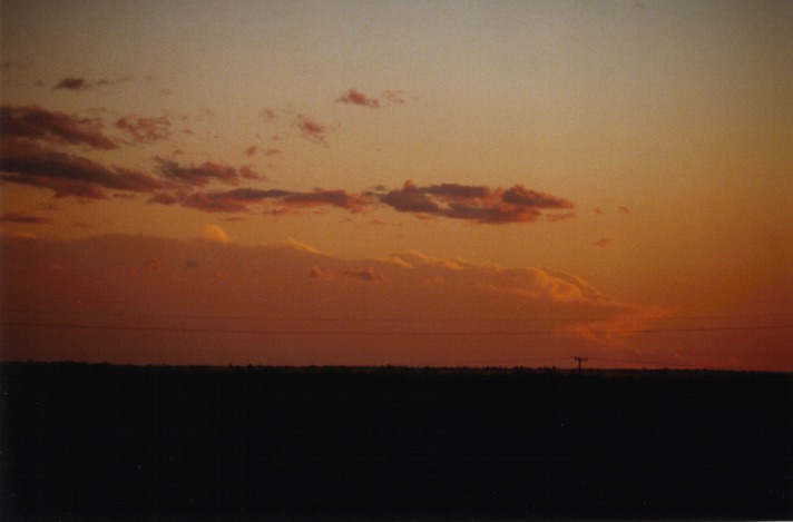
The group of chasers decided to travel to Miles about 140km to the east and wait there. We had decided that this was the target area for the best storms based on the best possible wind shear. The conditions were looking good for development of supercells that day: excellent shear and very unstable conditions although it would have been more ideal with more lower level backing. The models were indictating the winds aloft of about 30knot at the 850hPa level, 40-50knot NW wind at 500 hPa and then W-NW 100knot jet at the 300 hPa level. The early castellanus had disappeared generally to the east of Roma and towards Miles.
Large cumulus developed basically everywhere and we could already see cumulonimbus developing on the way to Miles but mostly on the ranges to the NE. Some had glaciated by about midday.
After lunch at Miles, we headed for a vantage point in town and found one on the eastern outskirts of town. From here we watched as cumulus pulsed and dissipated. It seemed that a line of storms were developing to the south and southeast of Roma! Radar updates of those storms indicated that even though they were on the edge of the range of radar, they still were showing high reflectivities. Whilst getting these updates, we saw another storm develop an anvil quite quickly through the haze. So it was decided to head south. (Unfortunately the road network is not as ideal for storm chasing but we made the best use of the roads possible).
From Miles, we headed south towards Condomine and then past Gumtree about 60km south of Miles. Cumulonimbus came into view with nice flanking lines becoming more spectacular as we closed in. I was focusing more on the major cell to the west probably located somewhere near Surat. It was difficult to observe its structure due to the haze but it was much larger in comparison to the cells to which we were headed. We finally stopped south of Gumtree and observed storms to the south, south east and south west. 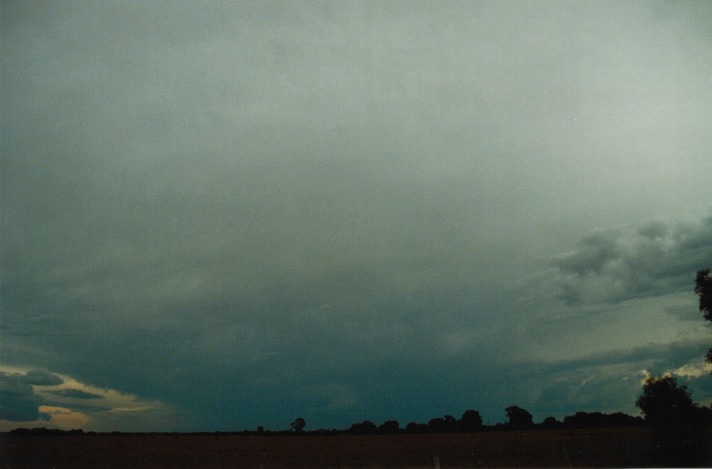 I concentrated on the structure of the major cell and could just make out a lens-shaped lower side or part of the base. It was too difficult to tell. I became edgy that we might miss this storm and tried my best convincing the guys that even though it did not look good (understandably) that it was a monster.
Finally, it was decided that we would head north to locate ourselves on the northern side of this cell. As soon as I left, I realised that this beast had the anvils diverging. It had not entered my mind that this was a supercell until this point!!! The adrenalin rush was now way out of control!!! Luckily I was in between the two other chaser vehicles or probably I would have taken off like a rocket.
 The further north we went to get into position, the better the storm looked. Trees obscured our view on some occasions as they lined the road side but we were still able to get a glimpse of the structure, with more and more of the northern side anvil becoming just visible. Suddenly just through a better gap I saw the ultimate!! I shouted "Wall cloud - well it looks like one anyway". Matt Piper went ballistic, trying to capture it on video. But travelling along the road and also trees made it difficult. The scene in the car could only be described as nothing short of crazy: instructions being given, excitement when the wall cloud came into view, panic to get the video footage of it in between tree areas and constant static on the radio. Finally Matt was able to get a glimpse of the wall cloud on video. However, when we stopped a few minutes or so later with a clearing in view, the wall cloud had become hidden or fell apart. But all the guys saw it and were full of excitement. It was suggested to find a better position up the road.
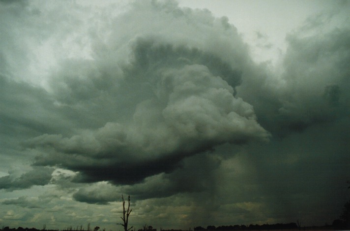
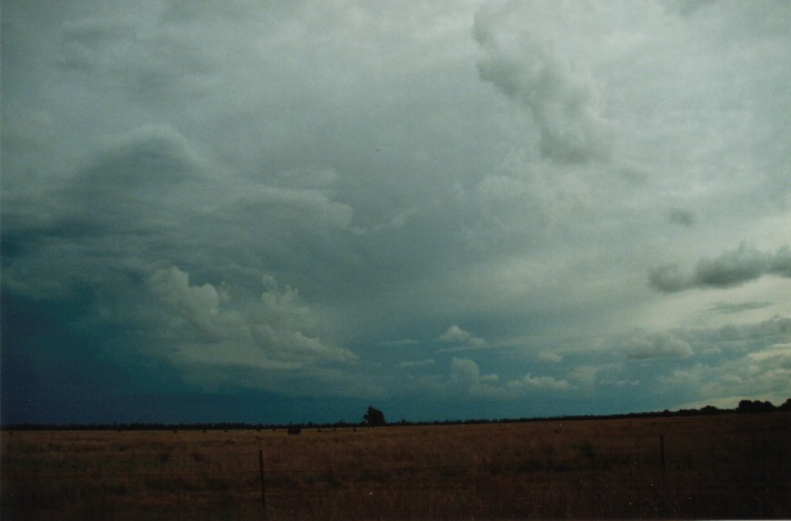
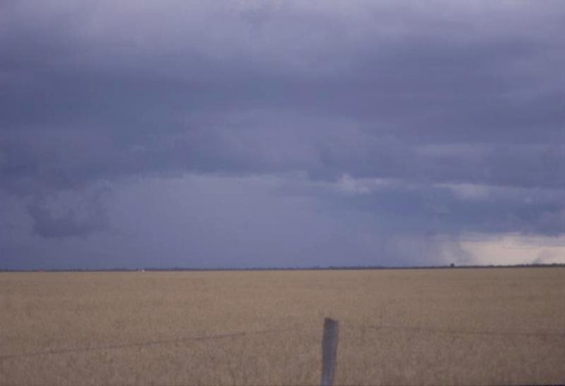
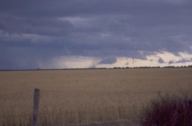
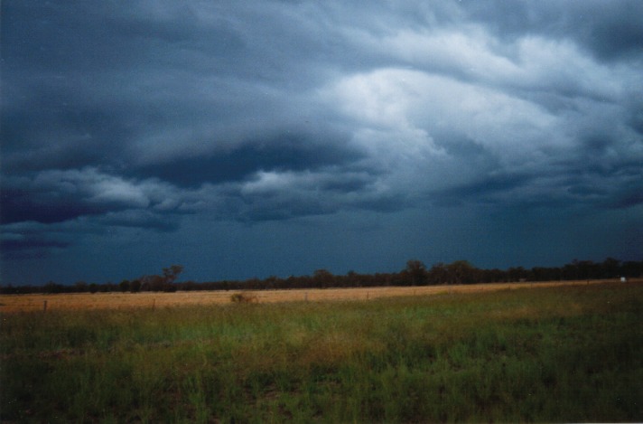
Just a few kilometres on and a wide expanse of treeless plains came into view and we signalled for a long stop. All cameras and a video were ready and focused practically within a minute. The static was still sounding off on the radio. This storm was huge with an anvil that spread way overhead and off to the east yet the storm was still some 30 - 50 kilometres to the west. It had a nice structure with the main core directed northwest to southeast.
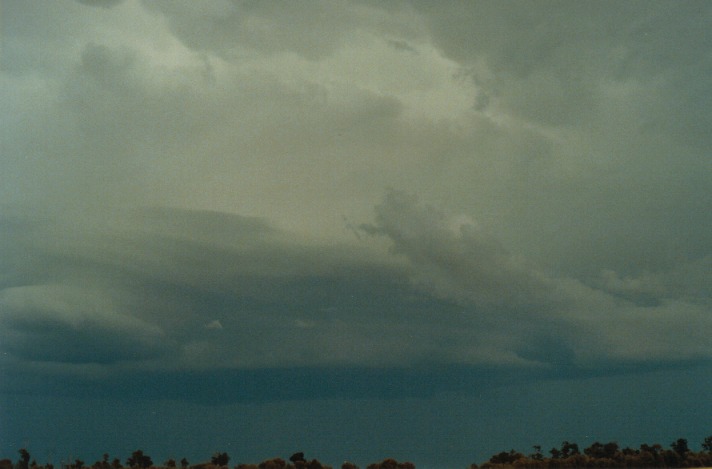
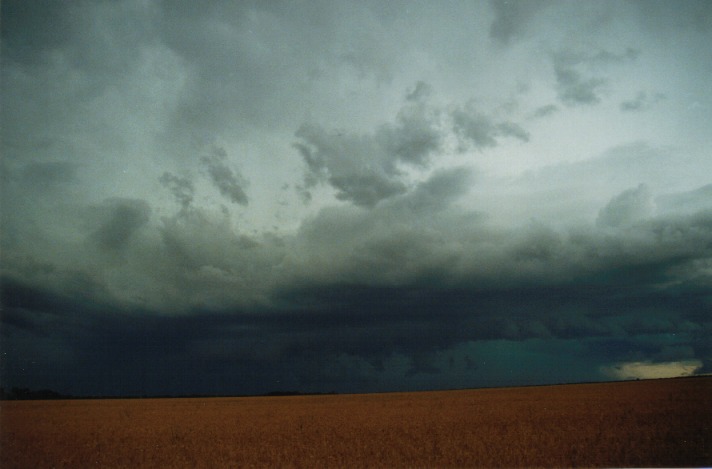
As the storm approached, the features improved. The light green tinge became more evident and some lightning bolts were observed. It was the northern flank that took my attention. It had closed in but now just before 4pm had begun to separate. The cumulus towers of the flanking line were exposed although high cloud was still overhead. Scud was being drawn into this flanking line from the powerful outflow of the downdraught or hailshaft area. At 4:05pm the gap between the outflow and lowered scud was wide enough to give full view of the rain free base area.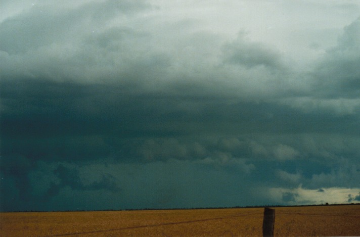
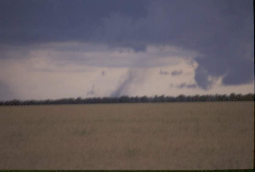
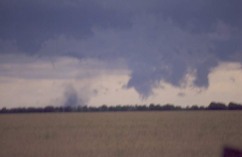
My thoughts the whole time was to watch for any activity below the scud area. This is where I was wrong. I had anticipated that any tornado that would drop would be in the area of the lowered cloud where the scud was flowing in. At 4:14pm a dust whirl came into view. Thinking it was a microburst I did not take much notice of it. But Andrew MacDonald then shouted out "Hey look at the dust whirl. Straight ahead Jimmy, straight ahead". When I zoomed in, there it was. The first dust whirls rising straight upwards. Soon after, more dust whirls began to develop and seemed to be rotating. The guys around me cheered. Andrew had become ecstatic: "This is what we came to see.."
Click here for the tornadic dust whirls video:
Tornadic dust whirls and the whole excitement captured on video (4.16mb)
I was confused. If this was a tornado, it had dropped into an area outside of where I thought it should have been. On examination of the video later, we saw a funnel that nobody had noticed that pointed in the area of the dust whirls. "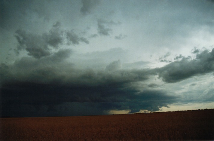 This was most likely a very weak tornado with no condensation funnel. More evidence from the video several minutes earlier was a persistent wedge shaped funnel cloud: probably observed around 4:05pm onwards and then gradually disappearing behind scud.
 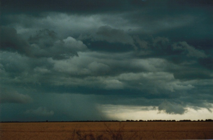 The dust whirls gradually dissipated and moved outwards perhaps in a NE direction well away from the rain shaft area.
As the storm neared, more threats of lightning overhead meant it was time to go. Our plan was to keep ahead of the storm. There were two road options. We could have headed N towards Miles and then SE towards Dalby. Alternatively we could move ESE towards Dalby by first going north to Condomine. This road would eventually connect the other road anyway. We took the second option. Unfortunately it proved to be the wrong option. It was mostly closed bushland and therefore visibility was difficult. I also misjudged the distance required basically 140 kilometres to Dalby.
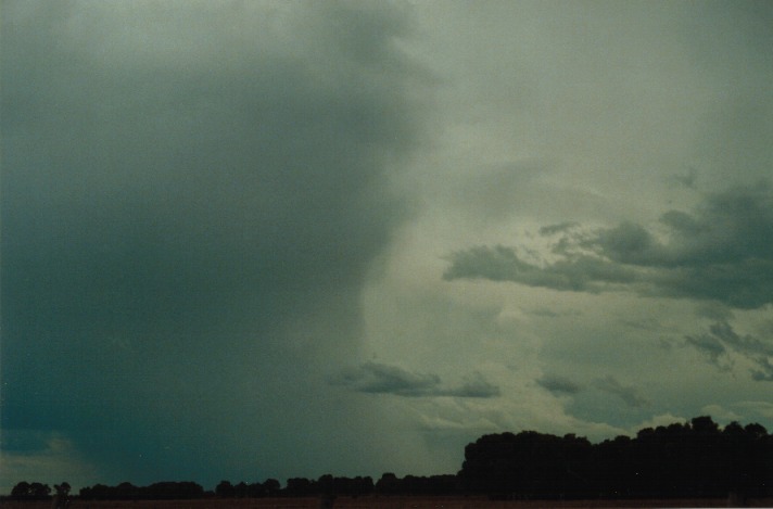
As we headed north to Condomine, there were two severe microbursts observed and videoed heading towards the car and kicking up dust. Matthew Piper sounded both worried and excited about the whole affair - "This is the best storm of me life!" We were able to escape both main areas of dust although we had some severe gusts rock the car a little.
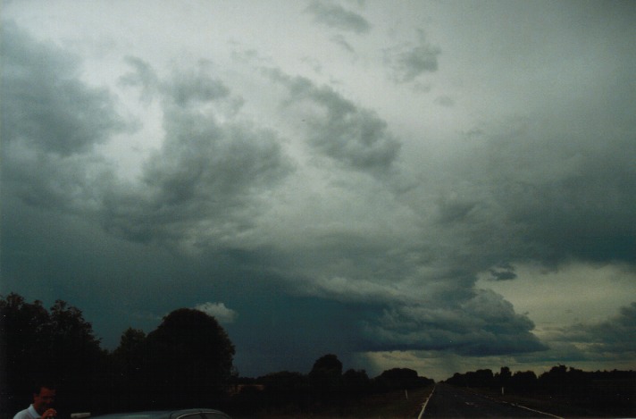
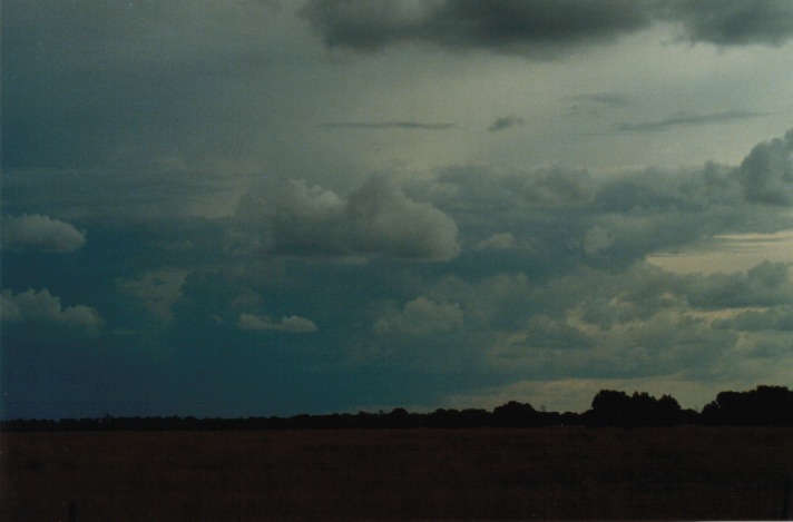
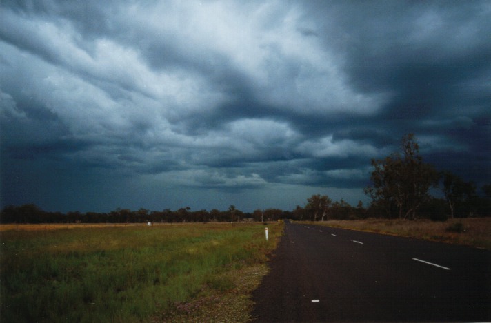 We took the route towards Dalby. Regardless of the trees, we were able to get glimpses of the storm on a couple of stops. It was showing more and more signs of changing into a squall line event. This was confirmed both visually and on radar. What surprised me is that this storm was sending microbursts well ahead of the main gust front.
The system was moving quite rapidly. There were several worrying minutes when strong wind gusts hit and minor branches and twigs were falling onto the road. I asked Matthew to help watch for anything that might come out of the trees. Finally we found ourselves ahead of the main gusts and soon headed back into open country. We turned back onto the main highway towards Dalby.
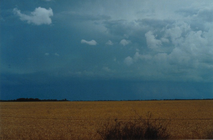
Another stop: this time we were viewing the whole system. The southern section was weakening although the northern section was still severe. Two cells had developed ahead of the gust front region and were beginning to merge. It was also electrically active. The Bureau of Meteorology in Brisbane was contacted by Paul Yole and a warning was issued for the community.
It was time for a quick fuel stop and I was hoping to head northeast from Dalby to locate on the northern side. Well we had to wait for the other crew to arrive and join with the convoy. When they arrived it was a very quick hello and we had to go. The attempt to go north failed as the road headed into the storm by heading slightly northwest. We then decided due to the ferocity of the winds and debri falling from the trees to head back to Dalby. After a few more hand shakes and discussion about the storm, the chase for that day was over.
This definitely was the best chase I had encountered. The positive aspects:
Perhaps some areas that could be improved:
Finally, since I will not be writing an account of the whole chase I must say it was an enjoyable and satisfying End Of Year Chase. A thankyou for all those who attended the chase and for Matthew Smith for organising it. I would like to thank Matthew Piper for having to put up with my constant instructions, my frustrations and nagging, being the scribe of the trip and the lack of rest. He was very versatile taking video from any directions and best of all whilst we were on the move. I think both he and I have learned from the whole experience as chase partners in the same vehicle for two weeks. After 6000 - 7000 kilometres, we were buggered.
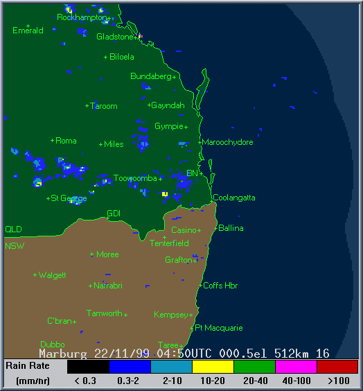
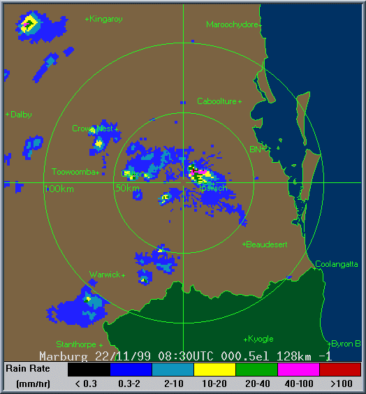
Radar
These images from Bureau of Meteorology
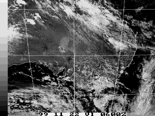
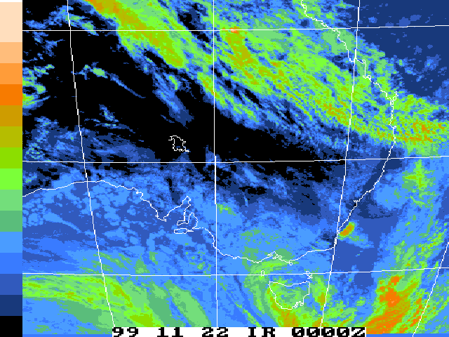
Satellite Images
These images from Bureau of Meteorology
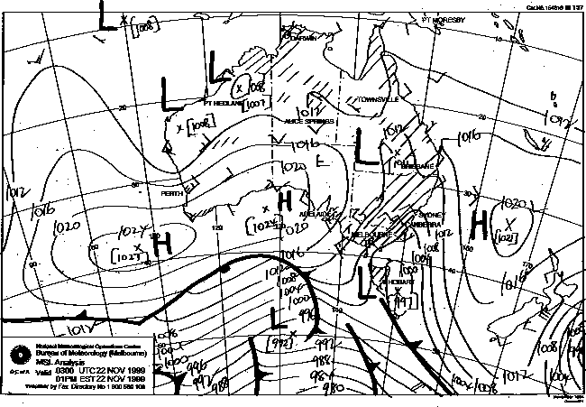
MSL Analysis Charts
This image obtained from Bureau of Meteorology.
2pm local 22nd November 1999
|
Document: 9911-02.html
Updated: 13th January, 2003 |
[Australian Severe Weather index] [Copyright Notice] [Email Contacts] [Search This Site] |