and Chasing
[Index][Archives]
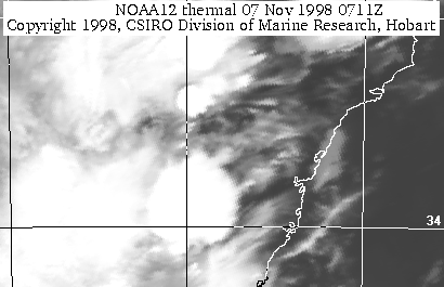
Sydney Storms: Saturday 7th November 1998
by Stuart Woodcock
| Storm News and Chasing [Index][Archives] |
Sydney Storms: Saturday 7th November 1998 by Stuart Woodcock |
I knew the day had been hot and a little humid around Glenmore Park in Sydneys West. I noticed small cell formation to the north. These cells moved off to the NE and produced no real results in our area. Humidity however seemed to increase on dusk.
At about 7:00pm we left for Landilo to a function in 6th Rd. There was still not a lot of action and it was getting dark so cloud formation ID was a little hard. After sitting through a nice feed and the presentations I noticed that the temperature was dropping and the wind was moving the decorations in the hall. This meant the wind was SW.
My wife told me that she had been watching a storm from where she was sitting for some time. I had my back to the west and so had not seen the preceeding action. Fortunately all was not lost.
We left the function about 10:00, as the wind picked up and lightning shafts where forming some good solid strikes around 5 - 7km away (still no rain). We first headed east along Sixth Rd with the lightning behind us. We then turned SW (road name unknown) for about 2 minutes. The strikes were definitely close, say 2 - 3km. I estimate from the road map and the storm action I later viewed that we where travelling along the front edge of the storm. This positioned us to view some excellent white shaft lightning and some green and purple tinged sheet lightning. The colouring I attribute to cloud thickness and rain at the storm front. We travelled along Second Ave and as we did we saw a huge strike I estimated to be 8-10km away. Immediately after the strike there was an orange glow and then 2 green glows. I haven't been for a drive out that way or called Prospect power yet but it looked as though a power sub-station or 33Kv stauntion may have been cooked. After travelling along Second Ave for a while we then turned west which I was hoping was right into the face of the storm. The storm however moving in a NE track moved around us and would've passed right over the Landilo area.
We arrived home to watch storm action from my front yard in Glenmore Park with good solid strikes north of Glenmore Park and the odd aerial action overhead.
We did not experience much rain but I am still to contact Glenmore Park Weather to find out the temp, wind direction, humidity and barometric pressure to gain a better picture of Saturday night.
And no (hitting myself with a hammer on the head) I did not have a camera. But if this is any indication of what Summer is going to dish up. It could be great.

|
Document: 9811-01.htm
Updated: 14th January, 2003 |
[Australian Severe Weather index] [Copyright Notice] [Email Contacts] [Search This Site] |